Record wet storm moves away, fog likely through Sunday morning

Denver and most of the Front Range measured 5 to 10 inches of unusually wet and heavy snow on Saturday. Temperatures hovered close to freezing all day which meant a combination of rain, snow, and slush.
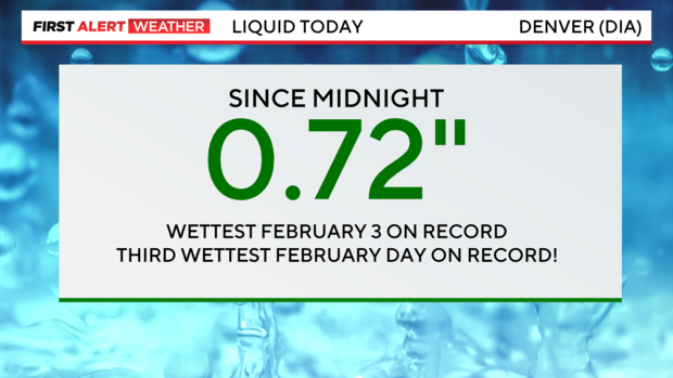
Most of the precipitation was rain in the morning before changing to wet snow in the afternoon. It was enough to fill up rain gauges throughout the region. The main Colorado State University campus in Fort Collins measured 1.53 inches of liquid on Saturday while Denver officially received 0.72". That easily broke the previous precipitation record for February 3 in Denver which was was 0.57" from 2012. Even more impressive, Saturday was the third wettest February day in Denver history.
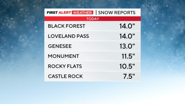
The heaviest snow totals were west of I-25 and south of C-470 in Douglas and Elbert Counties. The Black Forest received 14 inches of wet snow which matched Loveland Pass and Genesee.
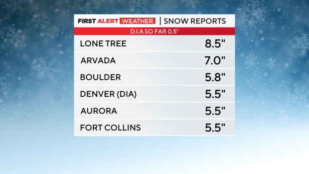
Snow amounts elsewhere ranged from 7.0 in Arvada to 5.8 inches in Boulder, and officially 5.5 inches of snow in Denver as measured at the airport. That is the highest single day snow total in Denver since December 28, 2022.
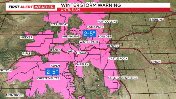
Any additional snow at lower elevations will be very limited Saturday night, but heavier snow in the high country will continue to cause slick and slow travel in the foothills and mountains into early Sunday morning. A Winter Storm Warning remains in effect for the mountains through 5 a.m. Sunday. Most areas including the I-70 mountain corridor between Avon and Georgetown will get another 2-5 inches of snow overnight.
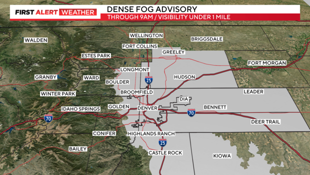
For the Denver metro area, the biggest issue Saturday night and Sunday morning will be fog. A Denver Fog Advisory has been issued until 9 a.m. Sunday for visibility under 1 mile.
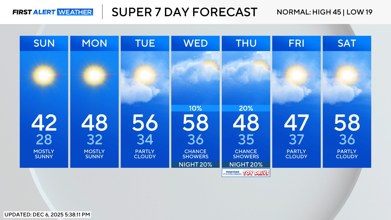
Much brighter, drier, and eventually warmer weather will develop for the start of the new week. A small chance for light rain and snow will return for the second half of the week. Temperatures will also turn cooler again starting mid-week.