First Alert: Rain & heavy mountain snow arrive Friday

Get your raincoat ready and grab that umbrella as much needed moisture arrives tonight into the weekend.
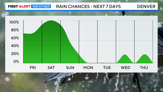
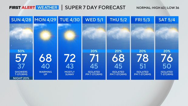
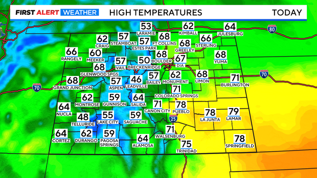
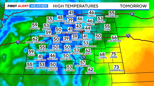
It will be cooler today, with daytime highs in the mid 60s in the metro area. Along the I-25 corridor, scattered showers will start Friday afternoon and become more widespread through Saturday with scattered thunderstorms possible.
Saturday is a First Alert Weather day due to snow in the mountains and heavy rain in the front range. Much cooler weather is expected on Saturday with daytime highs topping out in the 40s in the Denver metro area.
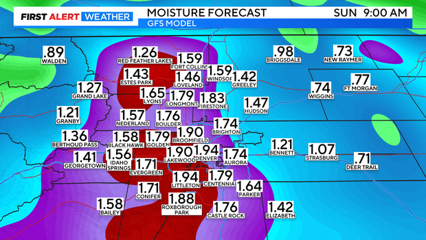
Saturday heavy rain is expected in the lower foothills, Urban Corridor, and eastern plains with 1 to 3 inches of rainfall possible by Sunday.
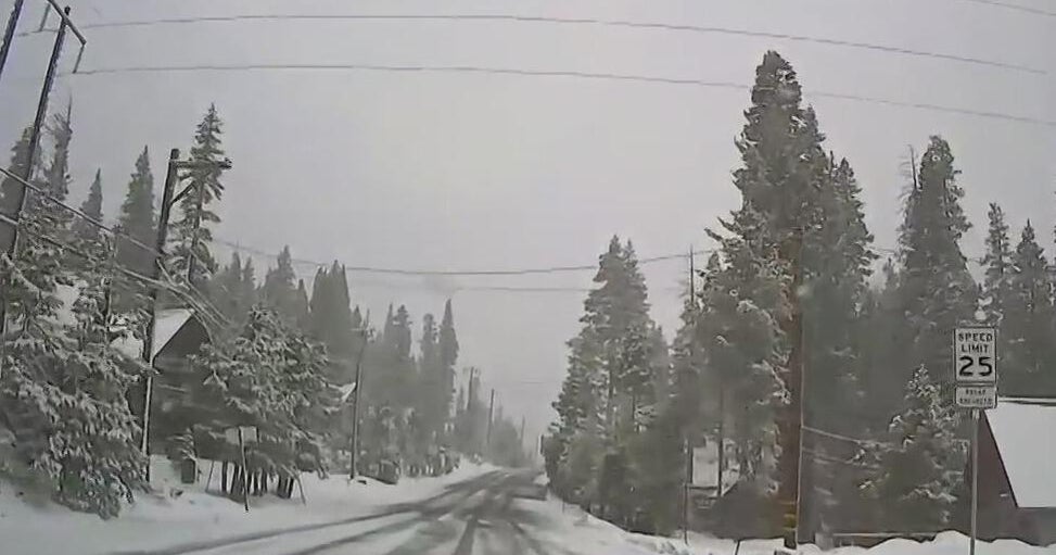
Travel could be tricky if you are heading to the high country or higher foothills. Snow will increase in coverage tonight, with snow continuing on Saturday before coming to an end on Sunday.
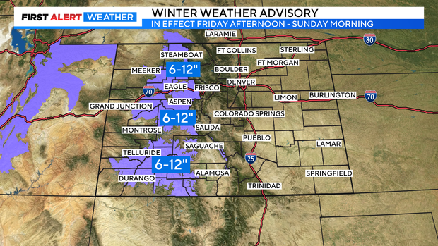
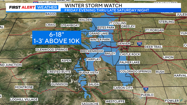
Snow totals could reach up to three feet of snow above 10,000 feet prompting a Winter Weather Advisory and Winter Storm Watch through Sunday morning.
Monday we turn a corner, sunshine will return with temperatures rebounding into the 60s. Next week, high pressure will build into the region with daytime highs returning to the 70s. A chance for afternoon scattered showers returns starting Wednesday through the end of the week.