Heavy snow, drenching rain and severe storms across Colorado

The worst of the rain and snow has shifted east of the foothills and I-25. A quick burst of heavy snow remains possible across I-25 through 5PM, but the steady activity continues pushing across the Eastern Plains.
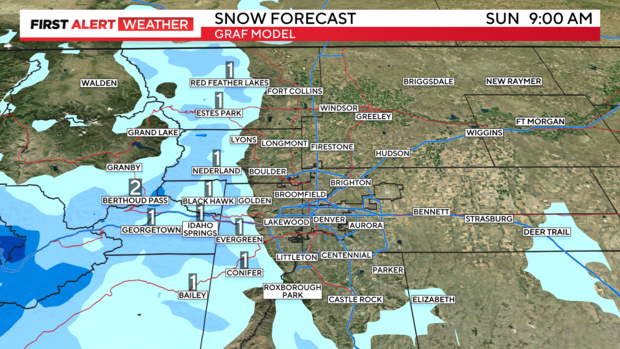
Our moisture packed storm system pushed in much colder air and a stronger upslope than was originally forecast. As a result, the drenching rain quickly changed to snow over many areas of the Denver metro and Front Range.
Additional snow amounts below 6,000 feet will be very small and mostly on grassy surfaces. The foothills will likely pick up an additional 1-4", with a few 6"+ reports possible at higher elevations.
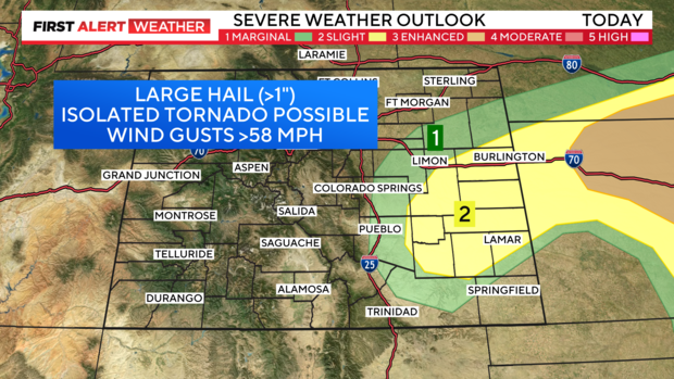
As the storms begins to pull east, a few severe storms are possible across the Eastern Plains. Large hail (1"+ in diameter), damaging wind gusts and one or two tornadoes are the main concerns for areas such as Burlington and Lamar.