Colorado Weather: Moisture starts increasing this week bringing a chance for showers
After a beautiful weekend, mild temperatures will continue all week while increasing moisture eventually brings a chance for rain showers, thunderstorms, and spring snow in the mountains.
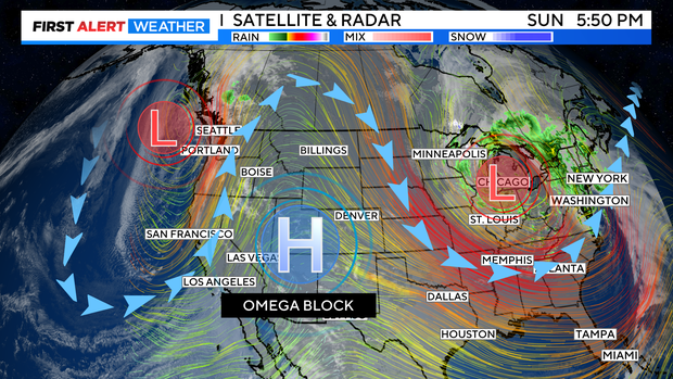
On the jet stream map we have what is called an "Omega Block" set up. A deep low pressure trough on the east coast is stationary. That is holding a high pressure ridge over the Rockies which in turn is holding another trough off the west coast. The three together look like the Greek symbol omega.
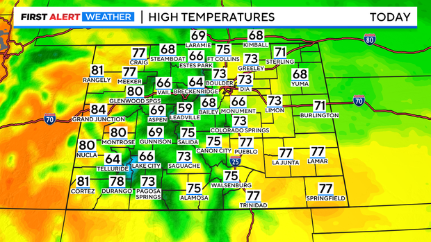
This weather pattern will boost temperatures across the state to above normal into the week ahead. In fact, for the Denver metro area 70s will be locked in through Friday while many areas on the Western Slope will reach the 80s on Monday.
With the extra moisture in place by Monday afternoon, a few light rain or snow showers are possible in the in the high country but most mountain towns will stay dry. A better chance for rain and/or snow will develop in the mountains on Tuesday. Summit County could see 1-2 inches of accumulation by late Tuesday evening.
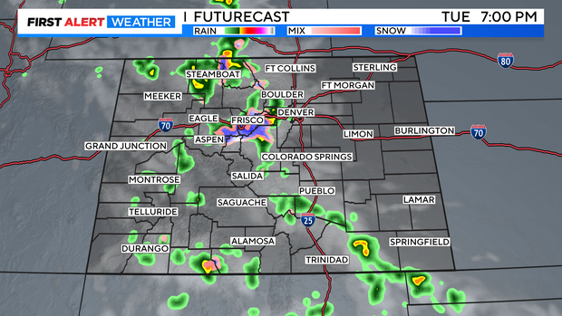
It will be far too warm for snow in the Denver metro area on Tuesday but there is a 30% chance for late day showers and non-severe thunderstorms. That chance will then continue through the end of the week with daily chances varying between 20% and 40%.