High fire danger with warm and windy conditions before cold and snow arrive in Colorado on Friday

Thursday will bring warm and windy conditions, leading to Red Flag Warnings across most of Eastern Colorado and the Front Range.
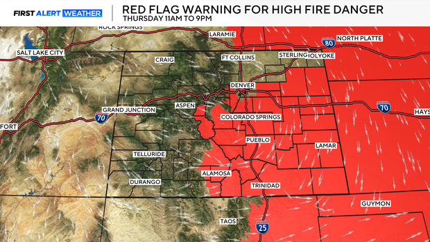
With temperatures climbing into the upper 70s and low 80s, winds will also climb. Gusts could reach 35-40 mph as the relative humidity could drop as low as 5%.
Now, enjoy that warmth while it lasts because tonight, everything changes.
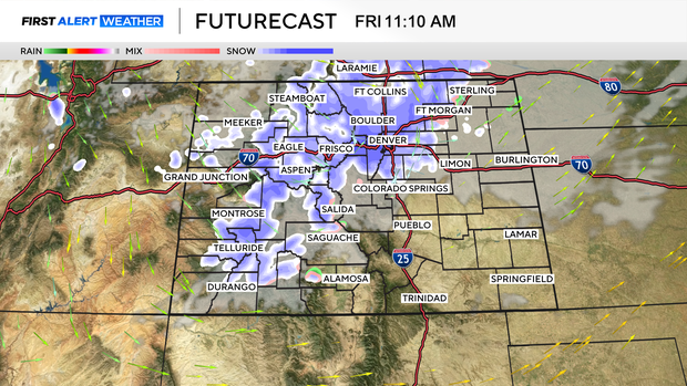
A cold front pushes in overnight through Friday, bringing clouds, dropping temperatures, and a chance of snow to the state.
By Friday, we're looking at snow showers arriving in the Denver metro area in the mid-morning, spreading to the Southeast throughout the day. Afternoon highs will only make it into the upper 30s to low 40s, nearly 40 degrees colder than Thursday. Breezy northwest winds will make it feel even colder.
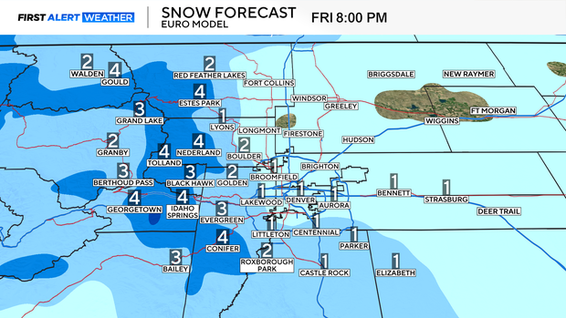
Snow totals across the metro area are modest, with most neighborhoods seeing a trace to 2" of snow. If upslope conditions develop, the foothills and Palmer Divide communities could receive 1-4" of snow. Most high-country areas can receive 2-6" of snow, with pass-level totals up to roughly 8".
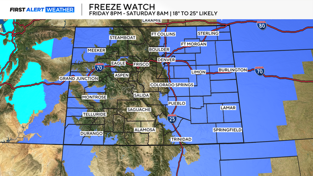
Saturday morning is the one to watch for gardeners and homeowners. Temperatures will plunge overnight into the teens and 20s, and Freeze Watches are posted across much of eastern Colorado, including Boulder, Jefferson, Larimer, El Paso, and Elbert Counties. If you've got plants in the ground or sprinkler systems running, you'll want to drain them if they're above ground before Friday night.