First Alert Weather Day: Bitter Cold And Bouts Of Snow Thru Mid-Week
DENVER (CBS)- Arctic cold continues to hold on to Colorado with bitter cold temps thru the end almost the end of the week. Another surge of snow blasted the evening commute on Tuesday with gusty winds and light snow. Enough to slow the drive down and make roads slippery just after sunset.
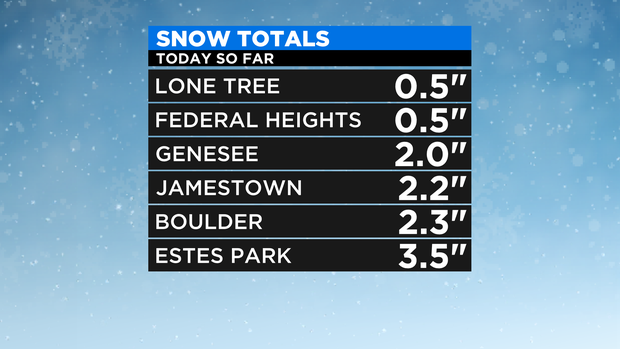
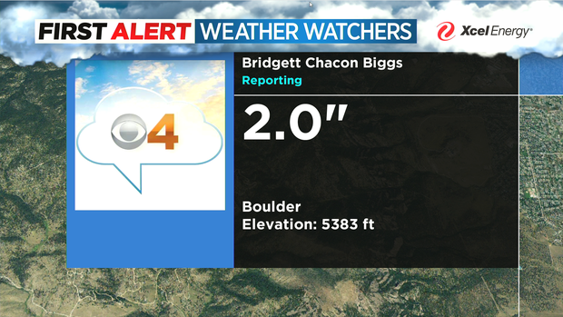
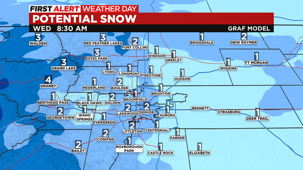
Snow amounts were light but ranged from a trace to 3 inches in some spots.
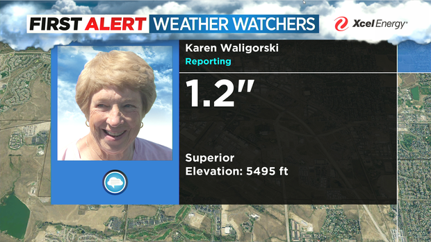
CBS4 Weather Watchers are helping to tell the story with some of their snow measurements.
Light snow will continue off and on thru Wednesday morning making for slick, icy and snow packed roads for the morning drive. With another 1 to 2 inches of snow overnight.
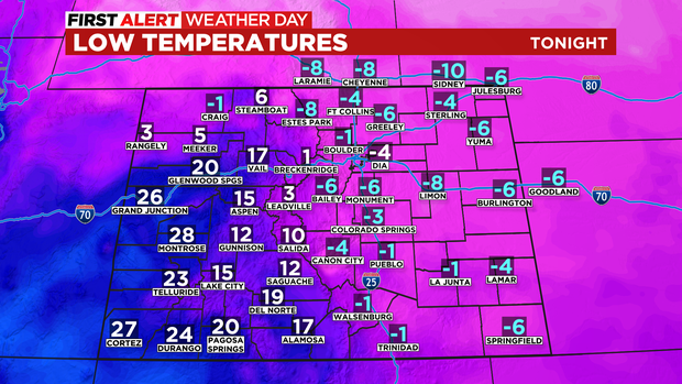
In addition to the snow, the big story is the cold.
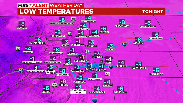
All areas on Eastern and Northwestern Colorado will drop below zero into Wednesday morning.
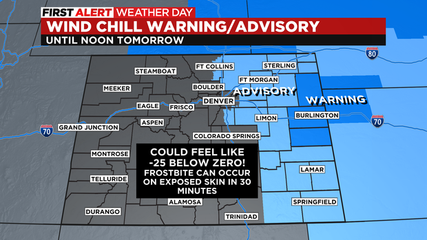
Add in 10-20 mph wind gusts and the wind chill for parts of eastern Colorado may feel like 25 below zero thru 11am on Thursday! Frostbite can occur on bare skin in 30 minutes with temperatures like that.
Denver missed its morning record low by 3 degrees but, set a record "LOW MAXIMUM" for Tuesday.
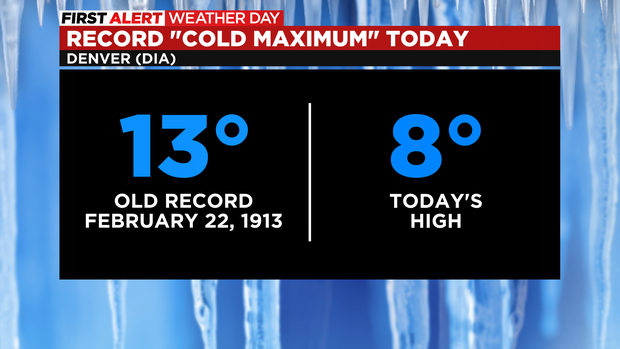
Meaning that's the coldest the high has ever been on Feb. 22.