Colorado cold front set to blow in strong winds, snow and rain
UPDATE: Read Thursday morning's Colorado weather forecast. Thursday is a FIRST ALERT WEATHER DAY
We are watching a major change in our Colorado weather pattern easing in with gusty winds and more clouds as your Wednesday goes on. A strong cold front will push through the Rockies late Wednesday into Thursday with rain in the lower elevations and significant snow in the mountains. There are two waves that will move through. One will bring showers and storms for Wednesday and the other mountain snow and cold temps on Thursday.
The first change will be strong winds, increasing clouds and showers in the mountains Wednesday morning with wind ramping up across the state.
Temperatures will be cooling down in the mountains and west with system moving in. Eastern Colorado will still be enjoying above normal highs.
Wednesday afternoon winds across Denver and the Front Range will be kicking up up to 25 mph gusts by afternoon.
Thursday will also be windy statewide. With gusts over the Denver metro area by afternoon up to 30 mph and in the mountains some gusts may top out at 55 mph.
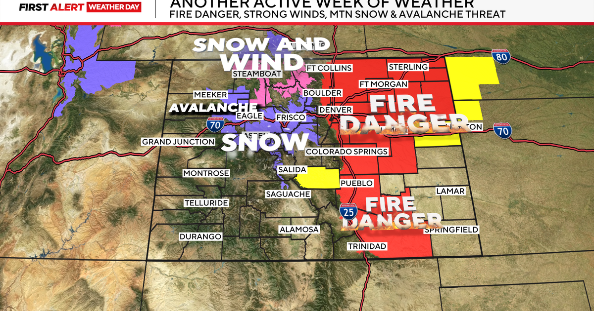
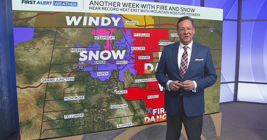
With the wind, dryness and warmth over southeastern Colorado there is a high fire risk over areas from Pueblo into southeastern areas of the state. A Red Flag Warning for high fire danger has been posted for Wednesday afternoon.
The second, more powerful wave will be the center of the low pressure trough itself pulling across the Rockies Thursday night into Friday morning.
This will drag colder air across the state along with creating a flow of moisture into northern Colorado that will result in significant mountain snow and off and on rain across the northeastern plains including the Denver metro area.
There are Winter Weather Advisories posted for the northern and central mountains of the state from 6pm Wednesday through 6am Friday. This will be the biggest snowfall of the season so far with most of the higher accumulations being at or above 10,000 feet. Some areas around Steamboat picking up 6 to 12 inches of snow. Driving could be difficult in the mountains Thursday morning through Friday.
There is also, a High Wind Watch for parts of extreme eastern Colorado on Thursday and Friday with wind gusts approaching 60 mph near and behind the storm system.
Rainfall amounts over Denver and the northeastern plains will be highest during the day on Thursday with rain developing in the morning and continuing off and on thru the afternoon. From Wednesday afternoon thru Friday morning parts of the Front Range from Denver up to Fort Collins could see a little over a tenth of an inch to a quarter of an inch the farther north you go.
The other story is the cold. With highs in the 50s on Thursday and Friday with the morning lows on Friday morning and Saturday morning at or below freezing. One of these may be Denver's first freeze of the season.


