Colorado prepares for big changes as snow moves back into the state

"If you don't like the weather, wait five minutes." We've all heard the saying before, and today that will ring quite true as Colorado prepares for a big shift in our weather pattern.
It has been above-average with mostly dry days across the state, but by Thursday night, that all changes.
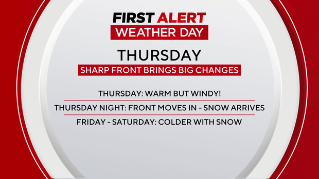
Fire weather for some will turn to Winter Weather Advisories as a cold front advances in late Thursday.
That front brings a dramatic drop in our temperatures and will bring heavy, wet snow to the state.
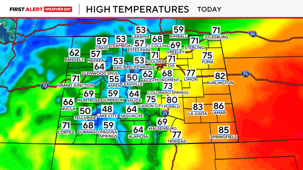
High temperatures on Thursday afternoon will be roughly 10 to 15 degrees warmer than normal across the state, climbing into the low 70s for the Denver metro area.
Wind speeds will also increase throughout the day.
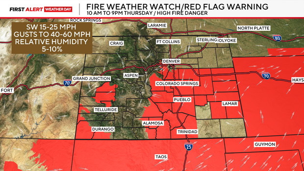
Red Flag Warnings will be in place from late morning Thursday into the evening hours as relative humidity drops and winds pick up.
For Central Colorado areas closer to the I-70 corridor, winds could gust as high as 45 mph. Further south, wind speeds could gust as high as 60 mph.
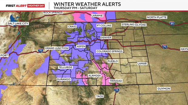
By tonight, some of those Red Flag Warnings will turn to Winter Weather Advisories, illustrating the dramatic shift in our weather pattern.
Winter Weather Advisories and Winter Storm Warnings will be in place across the foothills, Palmer Divide, and into the high country from Thursday night through Saturday, with snow moving in.
On average, totals in the mountains will reach 6-12" for most areas, with some places picking up a little more than 1 ft of fresh new snow.
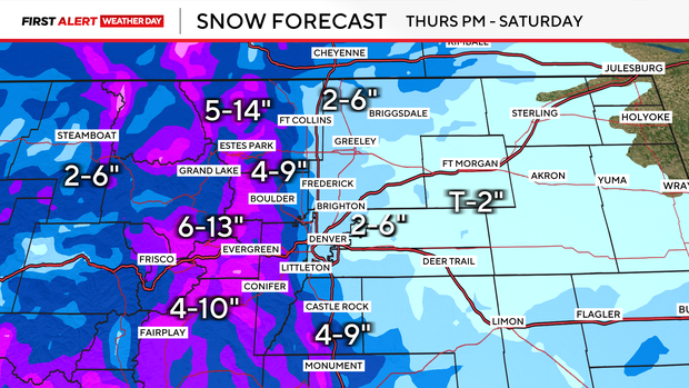
Roughly 2-6" of snow is expected for the Denver metro area, with higher totals expected in the higher elevations.
The Foothills and Palmer Divide could see 4-10 inches of snow.
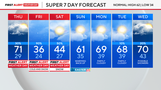
Snow lingers into the day on Saturday, gradually clearing by the late afternoon.
Temperatures rebound back to near-normal by Easter Sunday.