Colorado elevation study to impact "Mile High" marker at capitol steps and elevation of some 14ers
As our understanding of elevation and sea level continue to evolve, Colorado could see some changes including the official elevation of two of our mountains and the location for the "Mile High" marker at the steps of the state capitol.
With elevation being measured in a new way, official designations of some locations around the U.S. are set to change in 2026. That means two Colorado 14ers -- mountains that are over 14,000 feet -- aren't as high as we think and a marker indicating the 5,280-foot elevation mark on the steps of the state capitol building will have to be moved. Again.
Colorado has more 14ers than any other state in the U.S. with 53.
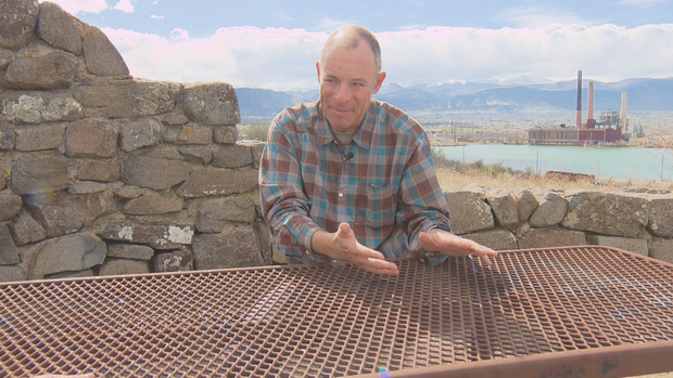
Derek van Westrum, the physicist and gravity scientist at the National Oceanic and Atmospheric Administration's National Ocean Service who led the study in Colorado, says two of our mountains are switching places in the rankings based on elevation. Born and raised in Colorado, he's climbed about half of our 14ers.
With the new data, Huron Peak is now the least tall 14er at a few inches shorter than Sunshine Peak. The findings are the culmination of a 15-year-long study by NOAA. And the study's implications extend far beyond those few inches of change.
Colorado also has more land above 10,000 feet than the rest of the country combined, making it ripe grounds for testing the technology used in the study.
"If the system works here, we know that it'll work anywhere else in the U.S.," van Westrum told CBS News Colorado.
The study emerged from a project called Gravity for the Redefinition of the American Vertical Datum. NOAA says all official height and elevation data used by the U.S. government relies on its findings.
"The existing national gravity holdings are insufficient," NOAA's 40-page project plan says, "to properly perform its mission to the degree of accuracy necessary."
Prior to the study, elevation data relied on "thousands of surveys, conducted by hundreds of sources, over dozens of years, and with no attempt to monitor changes in gravity over time in this data," the agency said.
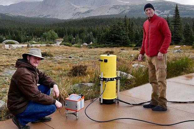
The study involved a deep dive into sea levels and how that impacts our understanding of real elevation on land. For 15 years, he and his team flew specially-equipped airplanes over the entire country.
"Sea level isn't ever exactly level," van Westrum said. "So if you can map out what that surface is, that's the new 'zero' for all of the heights we're going to do for the entire nation."
Studies like the ones he did in Colorado were also undertaken in Alaska, Arizona, southern and northern California, South Florida, southern Louisiana, Maine, the Great Lakes region of northern Michigan, Montana, North Carolina and Oregon.
Of the 60 highest mountains in the U.S., 16 will be changing in the rankings, data from NOAA shows:
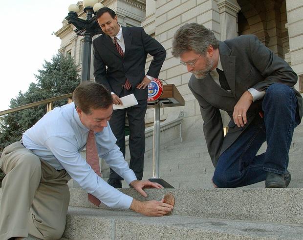
In addition to updated topography information for the state's peaks and valleys, the so-called, "Mile High Marker" -- the engraving and plaque at the capitol steps indicating the exact location of one mile of elevation -- will now have to move a few feet.
It was last moved for similar reasons in 2003. At the time, an elevation study found that the marker that was put on the 18th step in 1969 was 3.03 feet too high. It was moved down to the lucky 13th step. The words "ONE MILE ABOVE SEA LEVEL," are engraved on the 15th step.
Now, the marker will likely need to be moved back up a few steps, according to NOAA spokesman Theo Stein.
A spokesperson for Gov. Jared Polis' office said state officials will likely move the marker in 2026 for the state's 150th anniversary.
NOAA estimated in 2007 that the project would take seven to 10 years and $38.5 million, plus an additional $200,000 per year to maintain and monitor for changes in the data.
For van Westrum, the money and 15 years of work were well worth it: "It's fun for the hikers, it's important for the rest of the nation and, scientifically, we can prove that, 'yup, the new system works.'"