Colorado deploys wildfire-spotting aircraft to help respond to flooding in Southwest Colorado

Aircraft normally used to spot wildfires are now playing a different role in Colorado, helping emergency responders assess widespread flooding in southwest Colorado and the Pagosa Springs area.
The Colorado Division of Fire Prevention and Control has deployed both of its state-owned Multi-Mission Aircraft to gather information from the air, providing emergency managers on the ground with images and intelligence about flooded areas, washed-out roads and communities cut off by rising water.
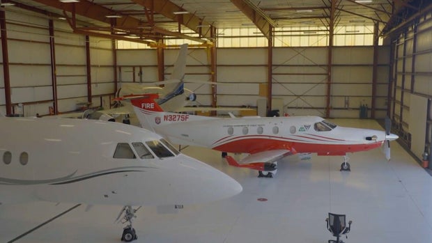
"We're kind of that top layer," said Jeffrey Rasmussen, Colorado's chief of fire planning, describing the aircraft's role in the emergency response.
Rasmussen said the planes have helped emergency managers identify areas in need of assistance and determine where to send resources.
"They have helped identify areas and direct resources into help people cut off from services, stranded, or what have you, and we are playing an instrumental role as MMA," Rasmussen said.
The aircraft are part of Colorado's Multi-Mission Aircraft program. Both are Pilatus PC-12 fixed-wing airplanes equipped with sophisticated imaging technology, including high-resolution color cameras and infrared sensors.
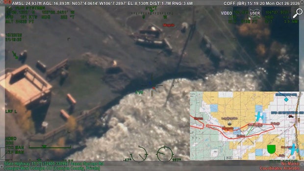
The technology allows crews to gather detailed information from thousands of feet above the ground. Video, images and other information can be transmitted to emergency managers in near real time, giving responders a broader picture of conditions in areas that may be difficult or impossible to reach by road. That information can help identify damaged infrastructure, locate areas isolated by floodwaters, and prioritize where emergency resources are needed.
From wildfire detection to all-hazards response
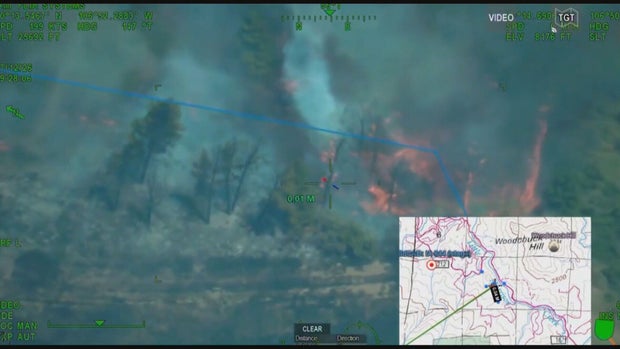
The fixed-wing aircraft have traditionally been associated with wildfire detection and response. The planes are equipped to locate fires, including small or smoldering fires that might otherwise go undetected, and provide incident commanders with aerial intelligence to help guide firefighting operations.
But the aircraft can do more than fight fires.
According to the Division of Fire Prevention and Control, the Multi-Mission Aircraft program can also support other emergencies. Their imaging, mapping, and communications capabilities can provide critical information during a variety of natural disasters like avalanches, floods, and mudslides.
Rasmussen said the state is increasingly finding uses for the aircraft outside the traditional wildfire season, particularly during the spring and fall.
The flooding response in southwest Colorado is another example of that expanding mission. The state has also used the aircraft to assist with flooding in New Mexico.
Flooding cuts off roads and threatens communities
The aerial assistance comes as southwest Colorado continues to deal with significant flooding, damaged roads and infrastructure, and mandatory evacuations.
Around Pagosa Springs, floodwaters have washed out roads and left residents isolated. The Colorado Department of Transportation also reported substantial flood damage to highways in the region, with sections of roadway undermined by floodwaters.
Aerial images can help document disaster damage
Beyond helping emergency managers assess immediate conditions, the aircraft's imagery and data can also provide documentation of damage caused by natural disasters. That information can be valuable as state and local officials work to assess the extent of damage and pursue disaster assistance.
Rasmussen said the state is happy to make the aircraft available wherever they can help.
The state said the aircraft were scheduled to return to the air over southwest Colorado Tuesday as the flood response continues.


