From the 70s to snow as sharp cold front snaps Colorado's warm stretch

After a stretch of warm spring weather, a fast-moving system is bringing a dramatic temperature swing to Colorado.
A strong cold front pushed through overnight, sending temperatures tumbling into the 30s and 40s by Friday afternoon and evening.
This quick-hitting system is also bringing snow to parts of the state.
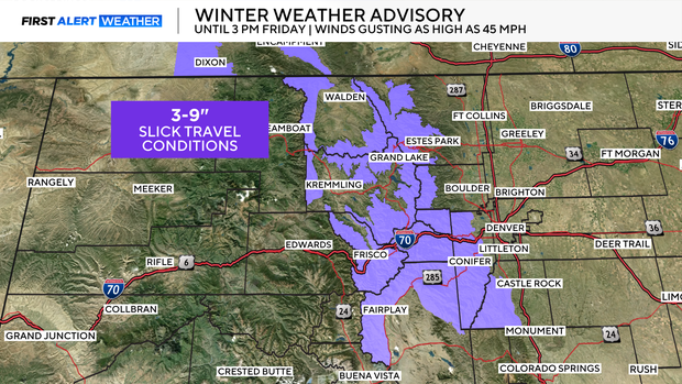
The snow reached the high country early Friday morning and will continue to fall throughout the afternoon. Winter Weather Advisories are in effect in the mountain and southern foothills through 3 pm Friday, where 3-9" of snow could fall.
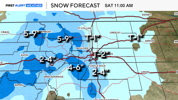
For the Denver metro area, accumulations will be light with a trace to 2" expected. Most of the accumulations will happen on cooler surfaces.
For the Palmer Divide and foothills, slightly higher totals are expected. Most communities will receive 1-4", but some higher elevations could reach as much as 6."
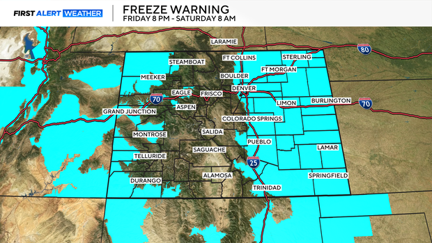
Once the snow wraps up, temperatures will continue to fall. A hard freeze is expected tonight into early Friday morning, with lows dropping into the teens and low 20s.
If you have plants outside, bring them in. Any in-ground pipes should be ok, but unhook garden hoses Friday night.


