Dangerously cold wind chills arrive, snow showers possible Thursday


CHICAGO (CBS) — A Weather Alert is in effect Thursday morning for the coldest temperatures in nearly a year—and dangerous wind chill values well below zero.
Wind chills were already below zero throughout the area, including within the city of Chicago, by the 10 p.m. hour Wednesday.
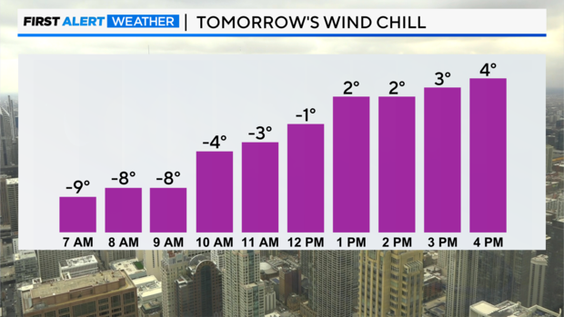
Biting westerly winds and a few isolated snow flurries are expected overnight. By sunrise Thursday, air temperatures will be in the single digits with wind chills approaching -20 degrees in some areas.
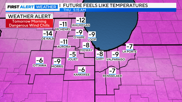
This will present a frostbite risk to those with exposed skin outdoors for more than 30 minutes.
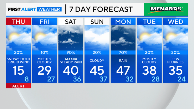
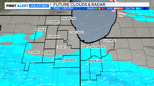
Clouds return on a frigid Thursday with a chance of afternoon snow along and south of I-80. Any snow showers that do develop are expected to remain south of Chicago entirely.
A wintry mix of precipitation returns briefly Saturday morning as temperatures warm quickly above freezing, transitioning to a cold, steady rain much of the day. Above-normal temperatures and occasional rounds of rain continue into early next week.
Forecast at a glance
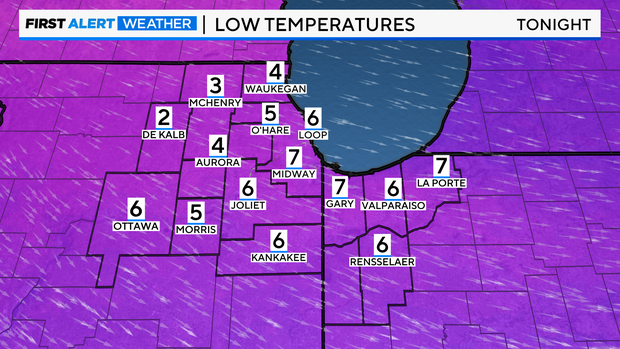
Wednesday Night: Mostly clear and frigid. Windy. Low: 5, wind chill -10 to -20 degrees
Thursday: Mostly cloudy with a few snow showers along/south of I-80. High: 15
Friday: Mostly cloudy. High: 29