Severe weather heading toward Chicago area Friday night; isolated tornadoes possible


A severe thunderstorm outbreak could hit the Chicago area Friday night as a line of storms crossing the Midwest reaches us, bringing damaging high winds and the possibility of isolated tornadoes.
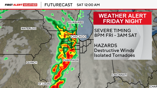
Storms are expected to move into the Chicago area between 9 p.m. Friday and 3 a.m. Saturday, and are expected to reach the city just after midnight. The threat will then shift to Northwest Indiana and is expected to be out of the area entirely by 4 a.m.
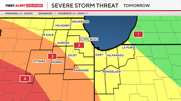
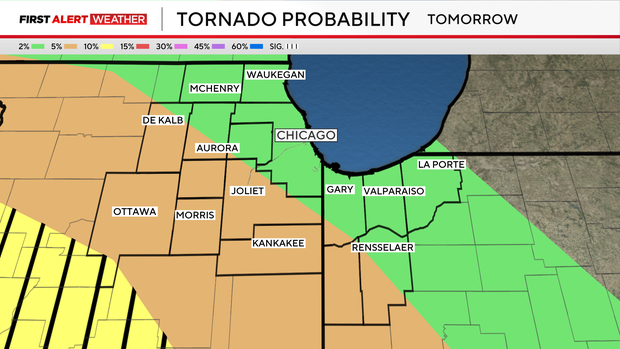
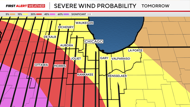
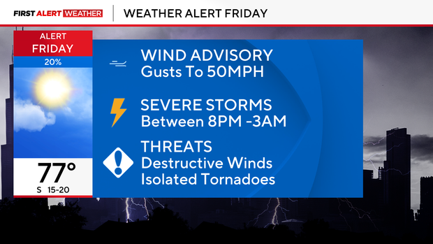
The biggest threats are damaging high winds with gusts up to 50 miles per hour Friday night and brief, isolated tornadoes.
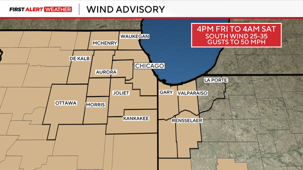
The National Weather Service has issued a Wind Advisory for Cook, DuPage, Will, Kankakee and Lake counties in Illinois and Lake, Newton, Jasper and Porter counties in Indiana from 4 p.m. Friday from 1 a.m. Saturday. A Wind Advisory has also been issued for Boone, DeKalb, Grundy, Kane, Kendall, La Salle, Lee, Livingston, McHenry, Ogle and Winnebago counties from 12 p.m. Friday until 1 a.m. Saturday.
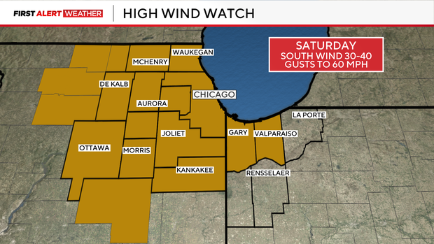
A High Wind Watch has been issued for Cook, Will, Lake, Kankakee, Boone, DeKalb, Grundy, Kane, Kendall, la Salle, Lee, Livingston, McHenry, Ogle and Winnebago counties in Illinois and Lake and Porter counties in Indiana from 8 a.m. until 3 p.m. Saturday.
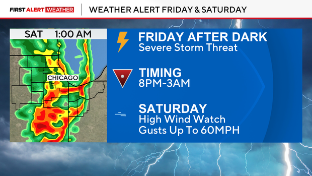
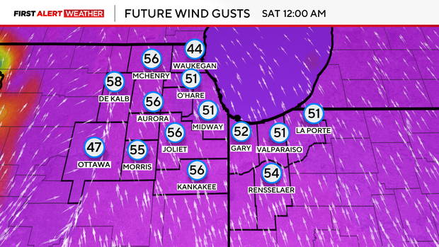
While storms aren't expected Saturday, there is a very real threat of damaging wind during the day with gusts that could reach as high as 60 miles per hour while the city is celebrating St. Patrick's Day.
Forecast at a glance:
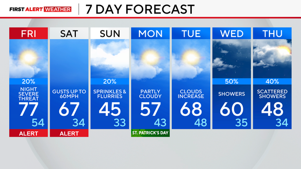
Thursday night: Becoming partly cloudy. Low 44.
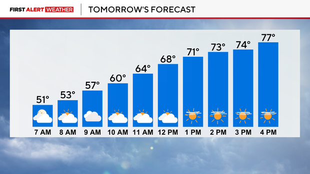
Friday: Windy and warm. High 77. Wind advisory starts at 4pm. Fire weather watch in place due to high winds.
Friday evening and night: Severe storm threat. All hazards possible. Low 54.
Saturday: High wind watch. High 67.
Sunday: Sprinkles and flurries. High 45.