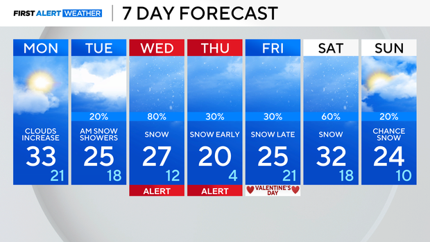
Active weather week coming with midweek storm system growing likely


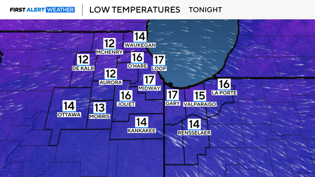
CHICAGO (CBS) — Mostly-clear skies Sunday night will drop overnight lows into the teens.
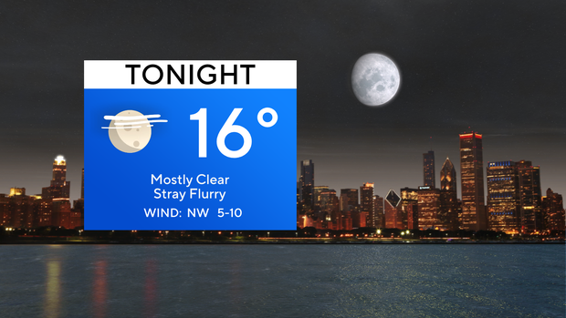
A few stray flurries will be possible, but most of us across Chicago will stay dry.
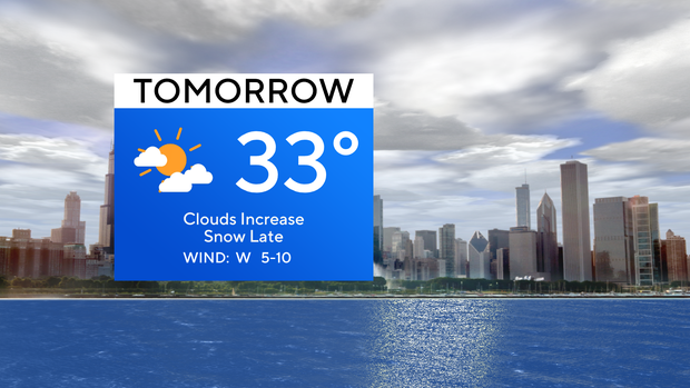
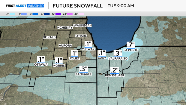
Increasing clouds are expected as we start our Monday, but by the overnight into Tuesday morning light patchy snow will roll through.
A dusting to 0.5" will be possible, but even then, it will not be widespread.
A bigger storm system is gaining confidence Wednesday into Thursday. This snowstorm looks to have a lot of moisture associated with it, meaning at least a few inches of accumulating snow right now are looking more likely.
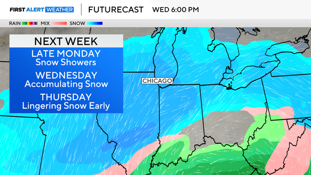
Exact numbers are still getting fine-tuned, but the CBS News Chicago First Alert team has posted Weather Alerts for Wednesday and Thursday to give you a heads-up about the incoming system which will impact travel area-wide.
Another system will blast through Saturday, with another round of snow. This week will also be colder with highs primarily in the 20s.
Forecast at a glance
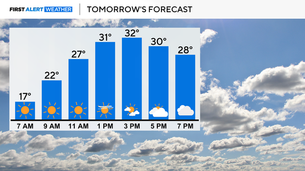
SUNDAY NIGHT: Low of 16, mostly clear. Stray flurry possible,
MONDAY: high of 33. clouds increase.
MONDAY NIGHT: snow returns late into Tuesday. Patchy dusting expected. Low of 21.