Chicago First Alert Weather: cooler Tuesday; heavy rain, possible icing Wednesday

A strong storm system moves out of the Southern Plains into the Midwest on Wednesday, producing heavy rainfall and a risk for some freezing rain.
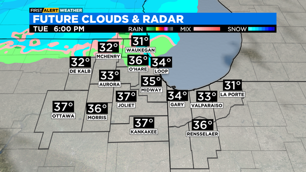
Ahead of the storm, we expect a cooler Tuesday with highs in the mid to upper 30s, and increasing cloud cover in the afternoon. There's a chance for a wintry mix/light snow Tuesday evening, but mainly for areas along the Illinois and Wisconsin state line.
Rain chances increase Wednesday morning. Some of the rain could be mixed with sleet. Rain chances become widespread by midday and some of the rainfall could be heavy.
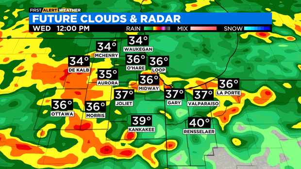
Temperatures in most locations will be above freezing on Wednesday, but it might be just cold enough for some freezing rain for areas north and west of Chicago.
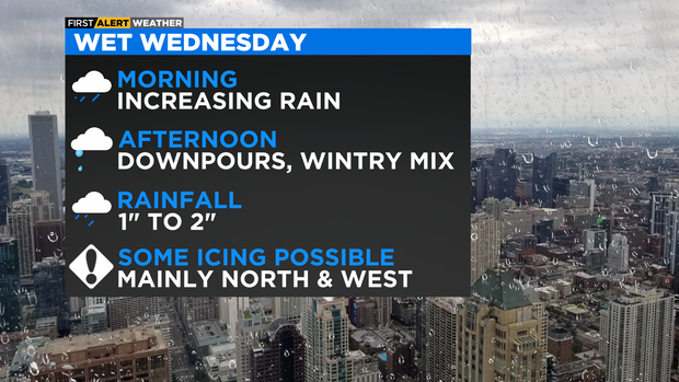
Rainfall amounts through Thursday night could reach 1 to 1.5 inches in many locations, with isolated amounts as much as 2 inches. Ponding on the roadway will be likely for the Wednesday afternoon and evening commute.
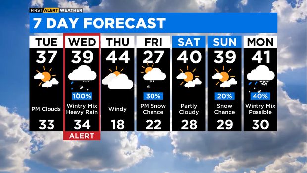
Behind this weather system, it will be windy and milder for Thursday. Highs will be in the low 40s, but wind gusts could be as high as 45 to 50 miles per hour. Colder air returns on Friday with highs in the 20s and a slight chance for snow showers for Friday evening.
TONIGHT: Partly cloudy skies and breezy. Low 27°
TUESDAY: Some sunshine in the morning, then increasing clouds in the afternoon. High 37°
WEDNESDAY: A 100% chance of rain and a wintry mix. Heavy downpours and some icing is possible. High 39°