Chicago First Alert Weather: Cold airmass arrives Thursday night

CHICAGO (CBS) -- After a beautiful Thursday with record highs in the mid 70s, a much colder airmass arrives tonight.
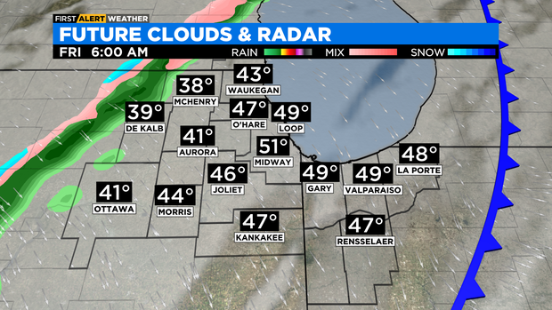
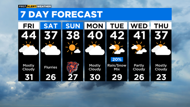
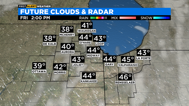
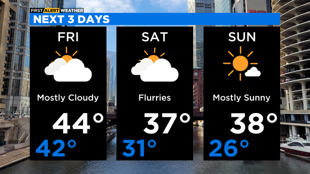
The strongest cold front so far this season moves into the area after midnight. Temperatures will fall to the 40s overnight and will remain in the 40s throughout the day on Friday. A passing shower is possible overnight through the early morning hours of Friday. Expect a breezy northwest wind Friday, gusting to about 20 miles per hour.
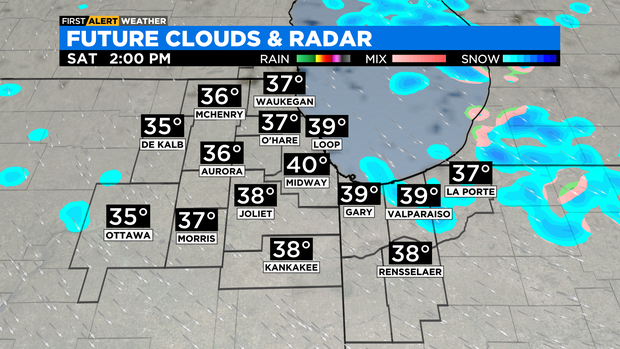
Saturday will be a mostly cloudy and cold day. There will be just enough moisture to produce a few flurries. Some lake effect snow is possible in La Porte County, Indiana. Highs on Saturday will be in the upper 30s.
Sunday will be mostly sunny for the first half of the day, then increasing clouds in the afternoon. Highs remain in the upper 30s.
A cold weather pattern remains with us next week with highs right around 40 degrees to start the week.
TONIGHT: Mostly cloudy with a 20% chance of rain. Turning much colder after midnight. Low 42°
FRIDAY: Mostly cloudy, breezy and colder. High 44°
SATURDAY: Mostly cloudy with a chance for flurries. High 37°