Storm system to bring rain, first snowflakes of season to parts of Massachusetts

A wet and raw storm system is moving in to end the week, with the first flakes of the season set to fly in some towns. While by no means a significant winter storm, it's the first winter-ish system of the season and the first snowflakes always bring a little bit of excitement or dread, depending on your perspective. Here's what you can expect as it moves through Thursday and Friday.
Timing It Out
The first rain showers will be possible Thursday morning, but mainly just for areas to the northwest side of Boston. More widespread and steady rain chances will head in from the south by Thursday evening, making for a gloomy and slow PM commute. Initially it's mild enough for just regular rain, but by midnight and beyond the atmosphere will start cooling down and allowing snowflakes to reach the ground.
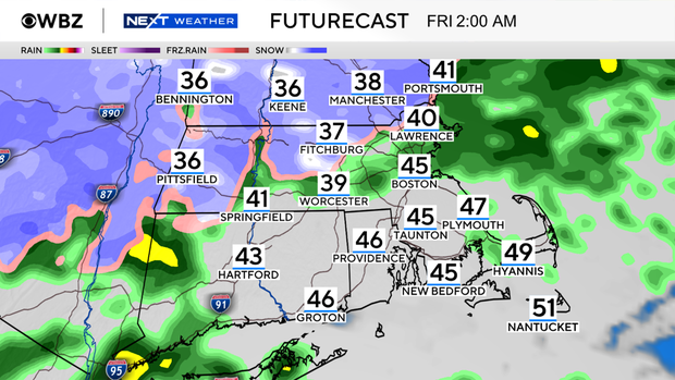
The most likely spots are interior areas and towns with elevation, as the air will be a bit colder there.
Rain and wet flakes will be steadiest overnight into Friday morning before trending toward lighter and more spotty precipitation during the day on Friday. Since temperatures are very borderline and rates won't be particularly heavy, we are not expecting much of any snow to stick on road surfaces.
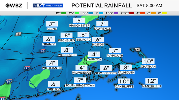
Rain totals for most towns should range from a half to one inch, much less than last week's deluge.
Will Any Snow Actually Stick?
Snow falling is one thing, but what really matters is whether or not it sticks. For the majority of towns, the answer is no. Just some spotty grassy coatings will be possible away from the coastline.
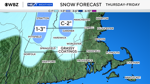
With some elevation, minor accumulations look possible. Coatings to an inch or so could fall in the Worcester Hills northward into western New Hampshire. A bit more is expected across the Berkshires and especially northward into the Greens of Vermont.
How Chilly Are We Talking?
We haven't had any days with highs in the 40s yet this season, which has made this the second latest on record we've held out before reaching that benchmark. Friday will be the chilliest daytime we've had since early April, so get ready to break out some heavier layers. The blustery northeast breeze will make it feel even cooler. And it will be a perfect Friday evening to throw a fire in the fireplace.
Is Winter Already Starting?
This is just dipping our toes into the cold season, not a full headfirst plunge. While we have some brisk conditions Friday through Sunday, another huge sprawling area of high pressure is expected to build-in next week.
This will bring us tons of sunshine and dry weather, along with moderating temperatures. Much of next week features bright skies and temps in the 50s and 60s. We may even stay dry all the way until right around Thanksgiving.