Maps give in-depth look at Boston weather forecast for major snowstorm this weekend
Boston is in for a one-two punch of winter weather this weekend. The forecast calls for an Arctic blast to bring extreme cold to the region, followed by a snowstorm that could dump a foot of snow or more in Massachusetts.
The WBZ Weather Team has been tracking the bitter cold and the potential for a major snow system all week. Take a look at the forecast maps below that show what you can expect, from below-zero temperatures to heavy snow that will make travel hazardous.
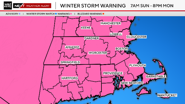
Winter Storm Warning
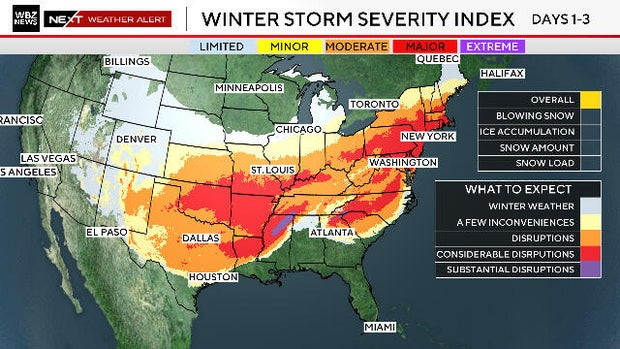
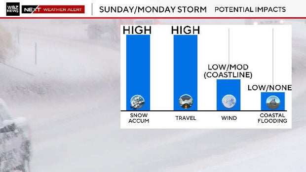
This is a massive storm system, affecting millions of people across a wide swath of the country.
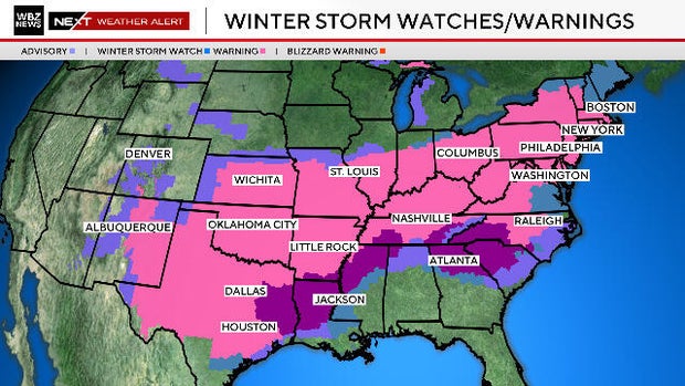
Winter Storm Warnings are in effect from New Mexico to Vermont.
All of Massachusetts is under a Winter Storm Warning from 7 a.m. Sunday through 8 p.m. Monday.
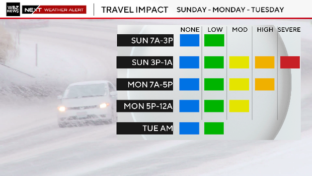
Snowstorm timeline and travel impacts
The snow will begin falling Sunday morning.
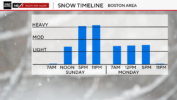
Expect severe travel impacts starting at 5 pm. Sunday.
The snow will start piling up on Sunday afternoon.
It will continue snowing through the day on Monday.
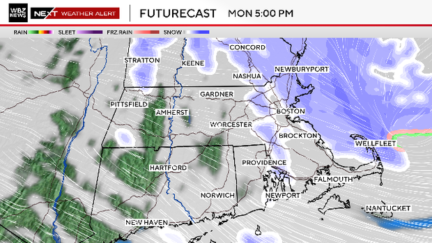
Click here for a detailed timeline of the storm.
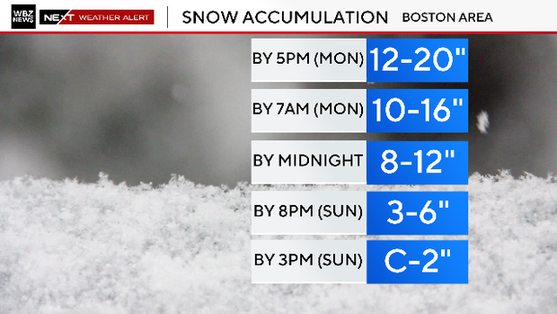
Snow accumulation
A widespread 12-20" is expected for most of Massachusetts. Lesser amounts are expected on Cape Cod, where the snow will be wetter and heavier.
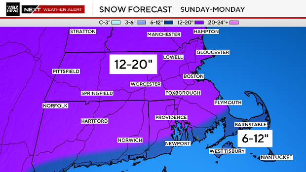
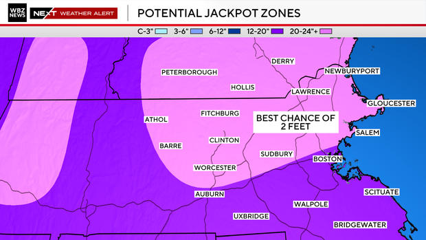
There are two potential areas highlighted in the map below that could see more than 20 inches thanks to ocean-enhanced snow bands or the "fluff factor" enhancing snow totals.
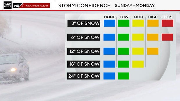
The WBZ Weather Team considers 6 inches of snow in Boston a "lock," and there's a high chance of at least a foot of snow.
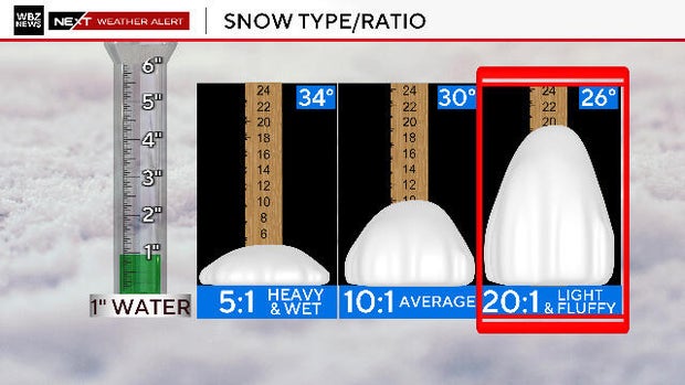
Snowfall forecast factors
The cold air will play a big factor in determining how high the snow totals get, thanks to the "fluff factor."
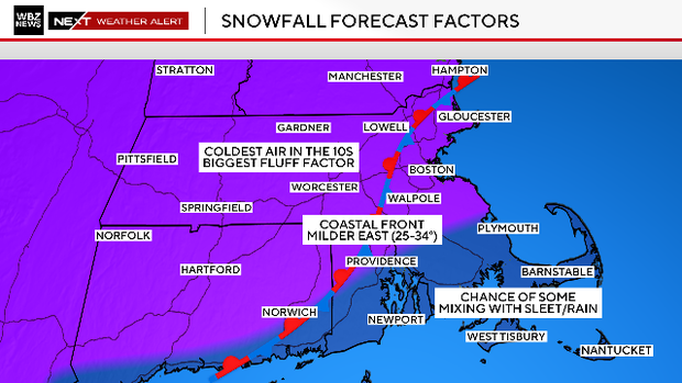
An inch of water typically produces 10 inches of snow, but the ratio will be much higher with this storm.