Watching Icy Patches & A Coastal Storm
Find Eric Fisher on Twitter and Facebook
Programming note: Since that epic Iron Bowl finish put the kibosh on our Winter Preview and viewers only got to see about 8 minutes of it, we will re-air it Monday night at 1030pm on WSBK-TV and again on Thursday night at 7:00pm on WBZ-TV. Hope you can join us!
What's harder than getting out of bed after a holiday weekend? Getting out of bed when it's gray and cold outside. Tough Monday morning for many, no doubt! But December (and with it Meteorological Winter) is here. And with it comes a change in the weather. After a pretty benign August-most of November, the jet stream is ramping up and bringing an increasing chance of storminess to our neck of the woods.
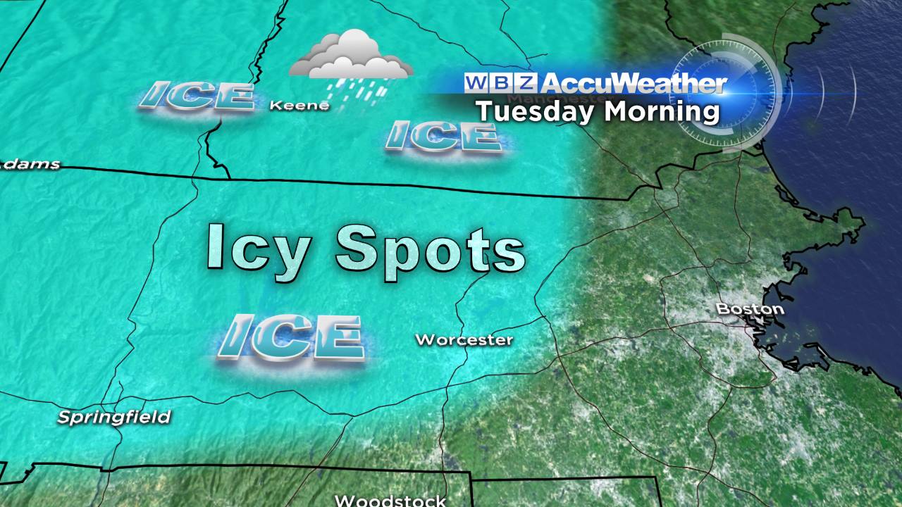
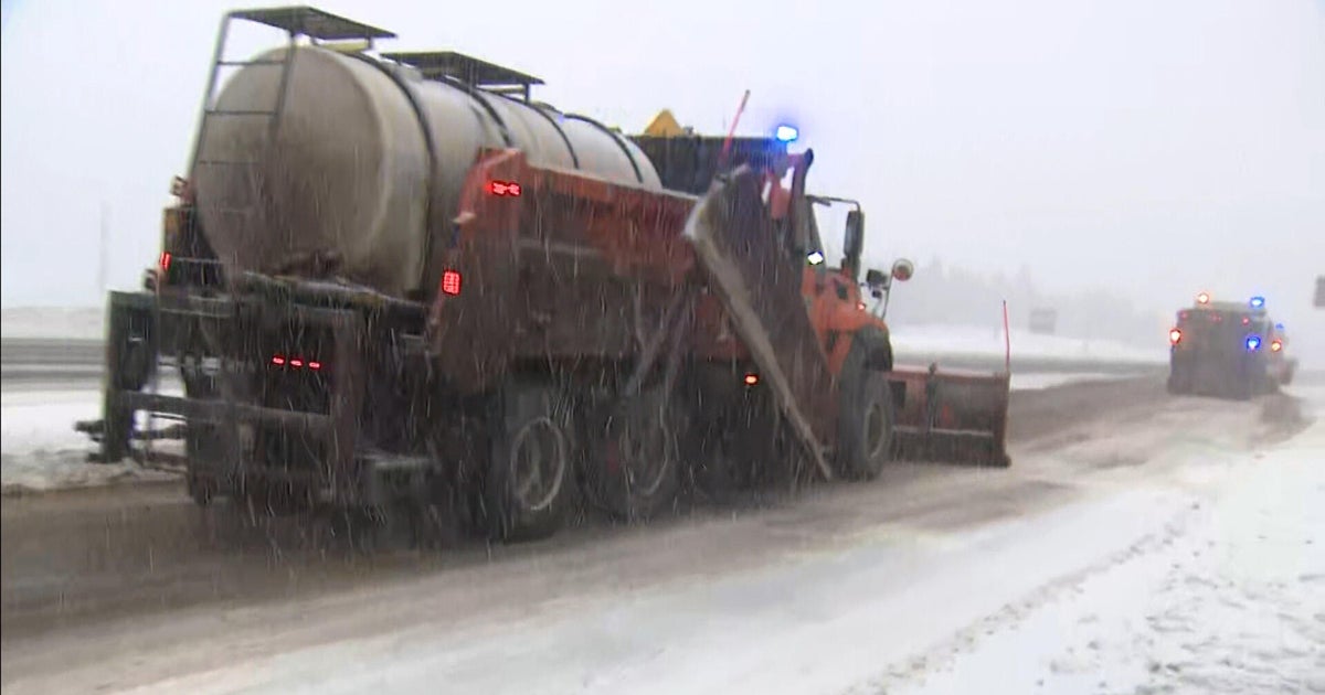
First up, the chance for some icy roads overnight tonight and into the am commute. Unlike what we saw on Sunday morning, there is no freezing drizzle. But we will see temperatures hovering at or just above the freezing mark for many locations, and the roads are damp from today's light rain and mist. It will only take a degree or two of cooling for many (especially west of Boston) to ice up those damp spots, so be extra careful traveling tonight. That risk will linger until 8 or 9am on Tuesday morning. Downtown Boston and the Cape/Islands/South Coast should stay mild enough to avoid the threat.
 Water Vapor loop of the East Coast, showing storm blowing up just out to sea!
Otherwise, the Tuesday story is one of a coastal storm just missing us. The center will travel east of the benchmark (40N 70W) and keep most of the precipitation out to sea. A few showers may graze the Outer Cape and Nantucket, especially in the morning. The clouds will hold on tougher across the Cape & Islands as well during the day, while interior towns should manage to brighten up with increasing sun. Breezy conditions will develop as the gale heads out, generally out of the NNW. That wind direction, combined with astronomically high tides (just past new moon phase), may lead to some minor splashover and coastal flooding. The National Weather Service has issued a Coastal Flood Advisory from Boston Harbor down to Cape Cod & Nantucket.
With a fast and active jet stream setting up, there will be lots of changes day-to-day through the weekend. Classic New England weather, just wait ten minutes. Wednesday will start off sunny, but clouds will move back in during the evening. An advancing warm front brings a few rounds of showers across Wednesday night and early Thursday morning, but not expecting big rain totals at this time. Temperatures will be borderline, but it looks like all rain for MA. Some freezing rain may be in the cards farther northward into NH, VT, and ME.
The air behind this front will be pleasant, so we should make the low 50s on Thursday afternoon with increasing sun! Not bad for December, and it should feel excellent. Could even sneak in a round of golf if you are feeling adventurous. But by Thursday night the next weather system will be on its way. This will be on the leading flank of a major Arctic Outbreak which will be slowly oozing across the country all week. Right now, it's not a total lock on heavy rainfall for us, but the potential is certainly there. The heaviest rain threat looks to be across our southern zones (MA, RI, CT) than to the north. Two impulses should move across, meaning two rounds of precipitation for us. Looks like all rain Friday, but the second batch could end as some snowfall Friday night into Saturday morning.
Below is the aforementioned Arctic invasion! This is some seriously cold air, which may end up breaking records in some parts of the country. The Pacific NW gets it first, then it seeps down across the West Coast & Rockies before spilling out into the Plains and across the south. By the end of the week, nearly the entire country is looking at below average temperatures! And not just below average, but -20-45º below average in some areas. That's some brutal stuff. The cold air may even lead to an ice/snow storm on Friday as far south as Texas, Oklahoma, Mississippi, Alabama, Arkansas, and Tennessee. The area of bright purple across the Mid-Mississippi is where snow is expected to fall and keep those communities colder.
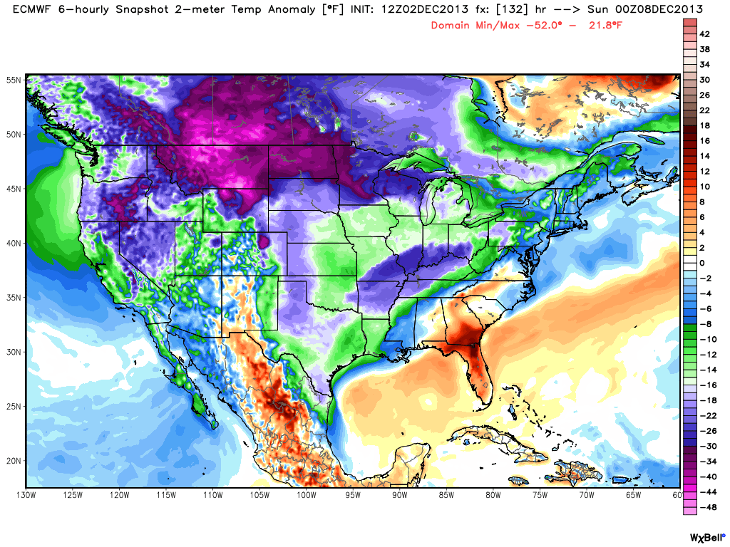
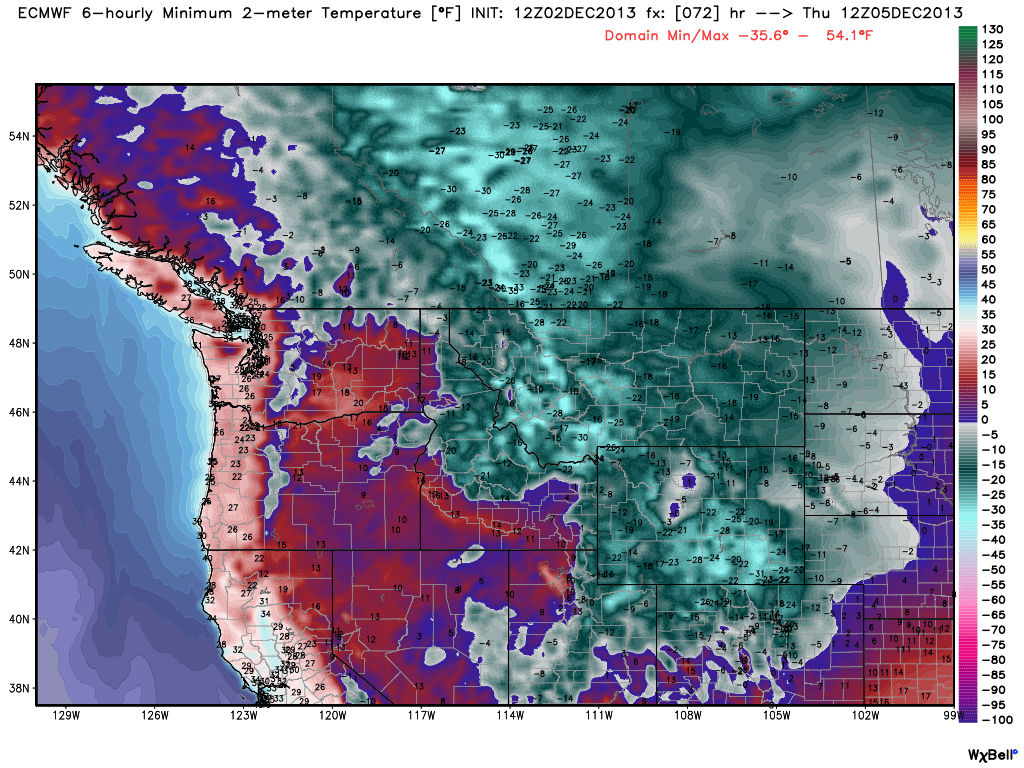
Model depictions courtesy WeatherBell
Early look at the weekend...
That brings us to the weekend....another tricky forecast. Storminess will be lurking in our neighborhood both days...living on the edge of cold and mild air masses. In general I have low confidence in the weekend forecast for now, due to that fast-paced jet stream pattern and the fact that we'll be so close to the clouds/precip. So don't go cancelling any plans yet! For now, it looks like a colder and drier Saturday and Sunday, with clouds advancing back in and thickening up on Sunday.
Many models have been hinting at a fairly classic cold-air-damming situation with this one, which is when high pressure to the north helps force cold air down the coast and up against the Appalachian mountain range. This cold air slips down as far south as South Carolina, and it usually the culprit of many a freezing rain/sleet event. You can see the pattern in this GFS forecast for Sunday night, which shows the wedge of cold air down into the deep south.
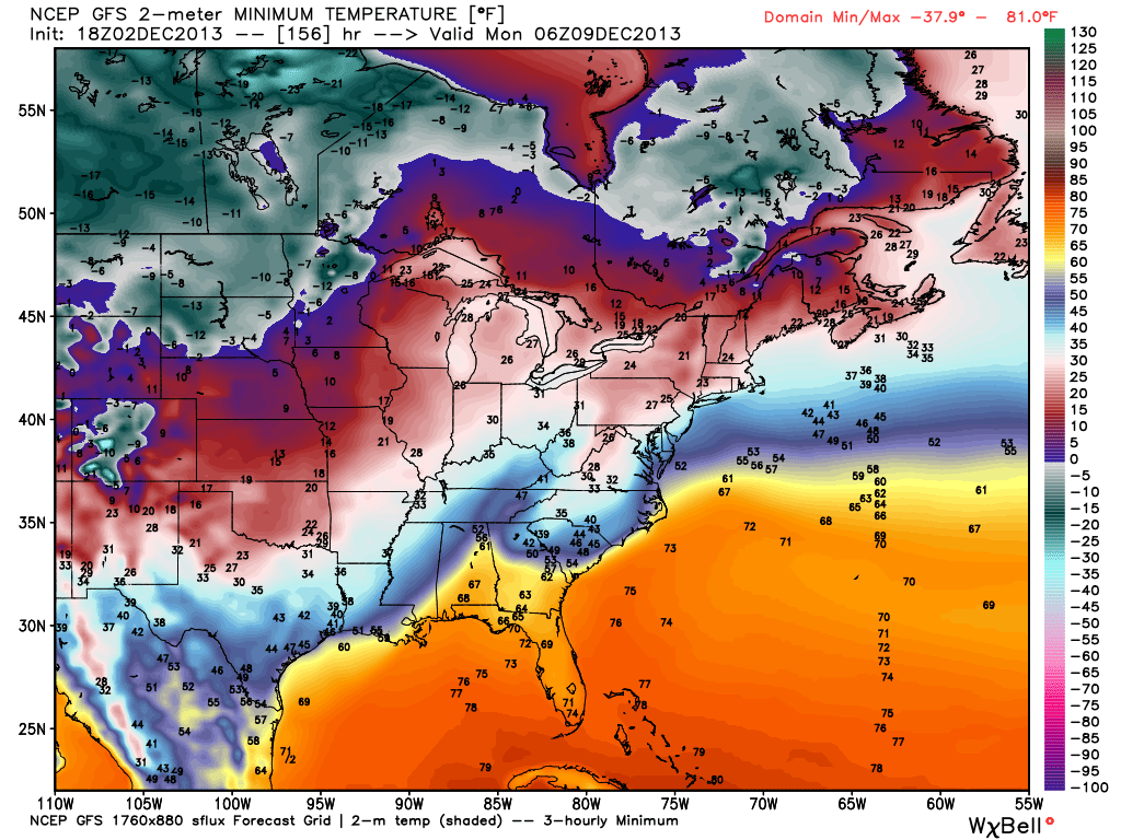
Even though it's cold at the surface, mild air will be surging up above this shallow layer of cold. So you can get rain falling into the subfreezing air, causing it to freeze either as sleet or on contact as freezing rain. With a storm this far out, it's pretty much impossible to give an accurate forecast for something like that. But the signal is there and needs to be watched, which we shall do! The high pressure to our north is in a good position to make it happen, especially across interior New England (although it's not a particularly strong area of high pressure, which may be a fly in the ointment). Stay tuned....
A few notes on Fall...
Here's a preliminary look back at autumn (September-November) temperatures across the country from NCDC. While each month was quite variable, the average of all three autumn months yields some pretty unspectacular results in terms of temperatures. Most areas within a degree or so of the average for the season. Just goes to show you what average is...the middle of extremes! Locally we went from the 5th driest fall on record in Boston to the 13th after the pre-Thanksgiving deluge. And November, which is dead-on average for the first 3 weeks, ended up -2.0ºF below average. That's all due to the very cold final week!
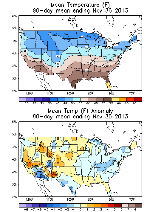
Data courtesy the National Climatic Data Center