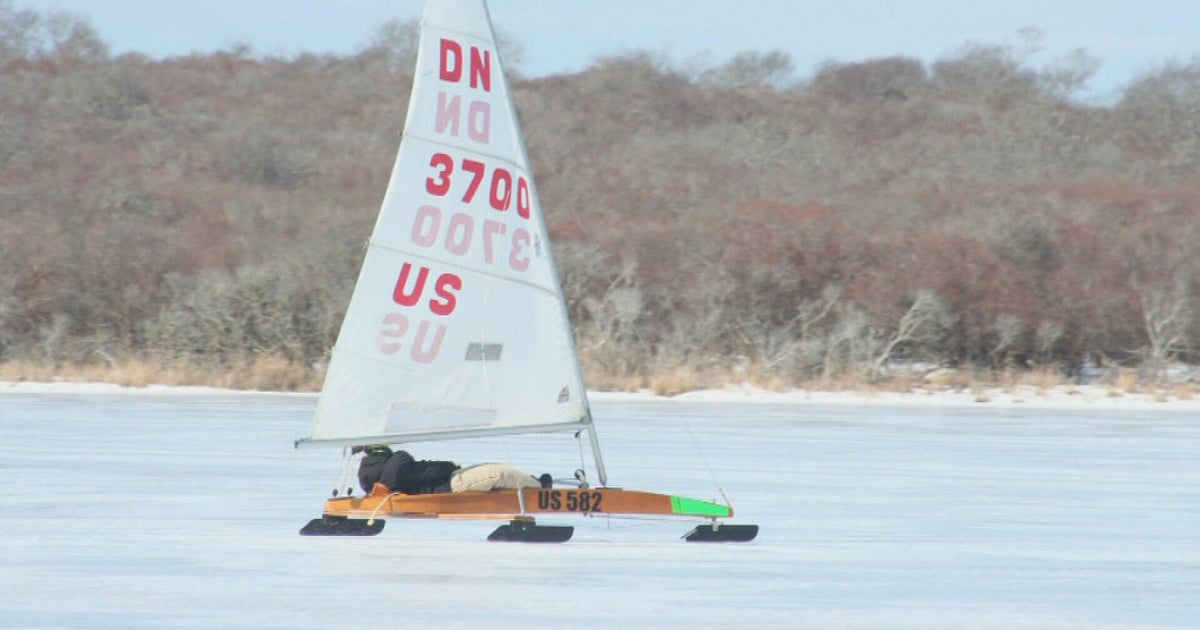
Icy Surfaces Remain A Concern As Arctic Blast Envelopes New England
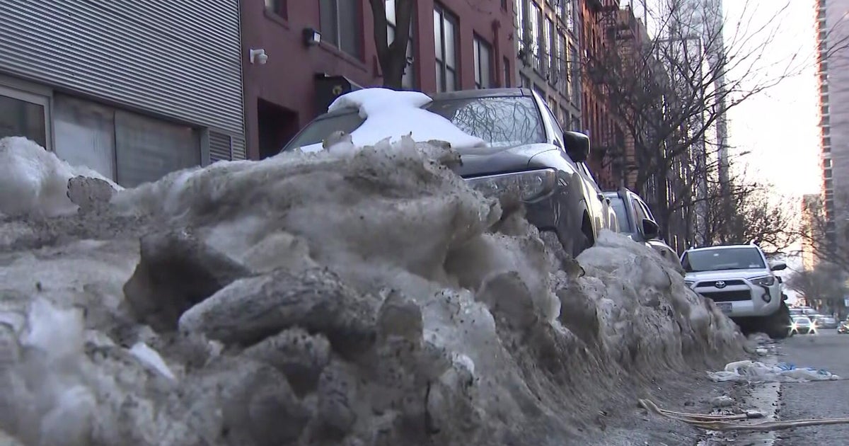
BOSTON (CBS) – After the weekend snow, ice and rain storm, it looks like a glacial winter wonderland across much of the region. That includes southeastern Massachusetts and Cape Cod, where it's icy from the flash freeze of the 2.5-4 inches of rain that fell.
Use caution in walking and driving the first part of this week. While road conditions have improved, icy areas remain especially on secondary roads and town streets. Also be careful walking on sidewalks, parking lots and driveways and going up and down stairs, etc.
As the wind continues to gust periodically up to 25-40 mph on Monday, watch out for any lingering snow and ice on trees that could fall to the ground primarily in a zone just north of, along and to just south of the Mass Pike. This may produce more downed branches and limbs and perhaps some isolated power outages.
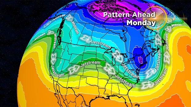
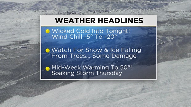
The big story in the wake of the storm is the arctic blast that really stings. The lowest high temperatures ever on record will occur across much of the region today.
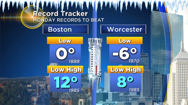
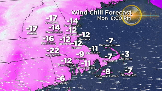
Boston's previous record of 12 will be broken by at least a degree or two and Worcester's record of 8 degrees will likely be broken by 2-3 degrees. The gusty wind will create 'real feel' subzero temperatures all day and into tonight.
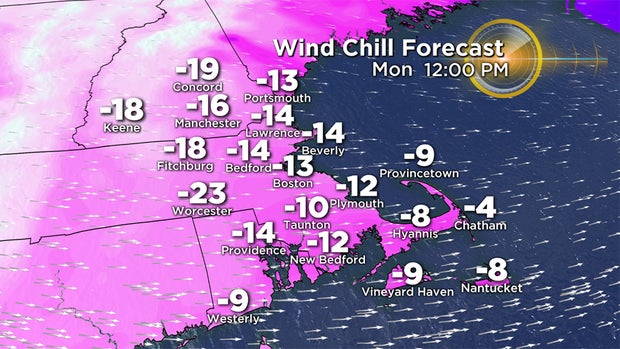
Bundle up in layers and protect flesh from frostbite during any outside treks. While it will be blustery again tomorrow, the wind will be decreasing and a warmer breeze will be setting in for Wednesday.
Fortunately, this insane cold will be short-lived as the roller-coaster temperature ride provides an amazing warm-up to near or past 50 degrees for this Thursday. With that warmth will come a round of robust rain for much of the area including the region north and west of Boston.
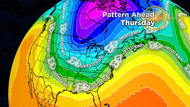
The amplified configuration of the steering currents will be in a state of flux so the temperature whiplash will go on this week and beyond. We will be keeping a close eye on the reservoir of frigid air in Canada because additional pieces of this arctic air mass will likely periodically break off and surge southward into portions of the country in the weeks ahead.
Follow Barry on Twitter @BarryWBZ