Heavy downpours, thunderstorms could bring localized flooding Tuesday
By Terry Eliasen, Meteorologist, WBZ-TV Exec. Weather Producer
BOSTON -- The WBZ Weather Team is issuing a NEXT Weather Alert for Tuesday. A cold front moving through later Tuesday will produce some heavy downpours and thunderstorms, along with some localized flooding.
Two days in a row?! Amidst our worst drought in six years, we are tracking some significant rainfall for the second straight day. Yesterday's rain came via a warm front and was mainly focused along the Coastline, in particular over parts of southeastern MA. The rain today comes with a cold front and should be focused more inland.
TIMING: Storms will build across Western MA as early as 1-2 p.m. this afternoon. The bulk of the action today will occur between 2 p.m. - 8 p.m. During that window, there could be several, scattered, slow-moving storms. We don't anticipate storms surviving much past 8 p.m.
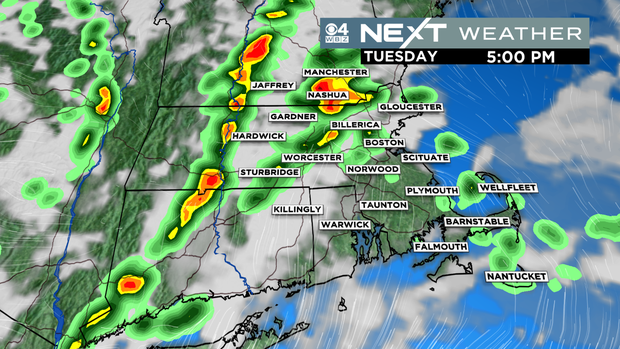
LOCATION: Highest chance of beneficial rain/downpours will be inland. Western and central MA have the highest chance of storms. While a few storms may survive the trip into eastern sections, the best chance lies west of 495.
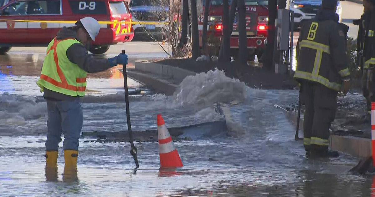
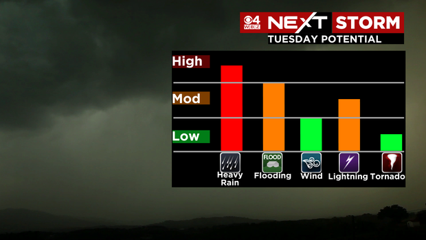
IMPACTS: The biggest threat associated with Tuesday's storms is heavy rainfall and localized flooding. Due to the slow-moving nature of the cells, some areas could receive a few inches of rainfall in a relatively short period of time. There may also be some lightning and isolated areas of damaging winds. Overall the threat of severe storms is low.
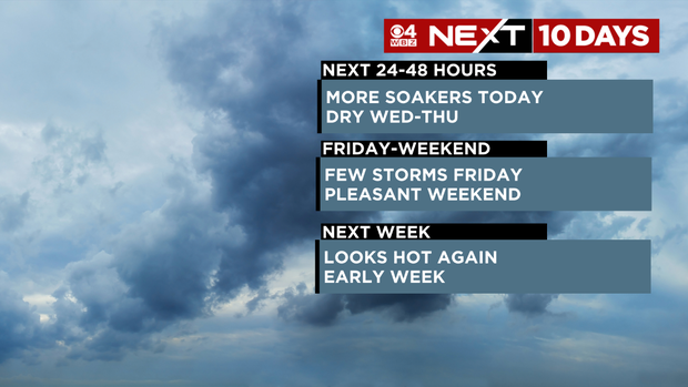
WHAT'S NEXT: We dry out for a few days (Wednesday and Thursday) before our next chance of a few thunderstorms on Friday. So far, the weekend looks pleasant. Early next week looks hot again with perhaps more storms around Tuesday or Wednesday.