Good Night Irene
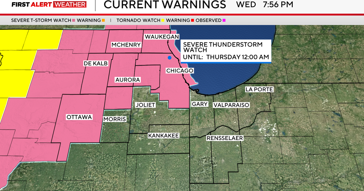
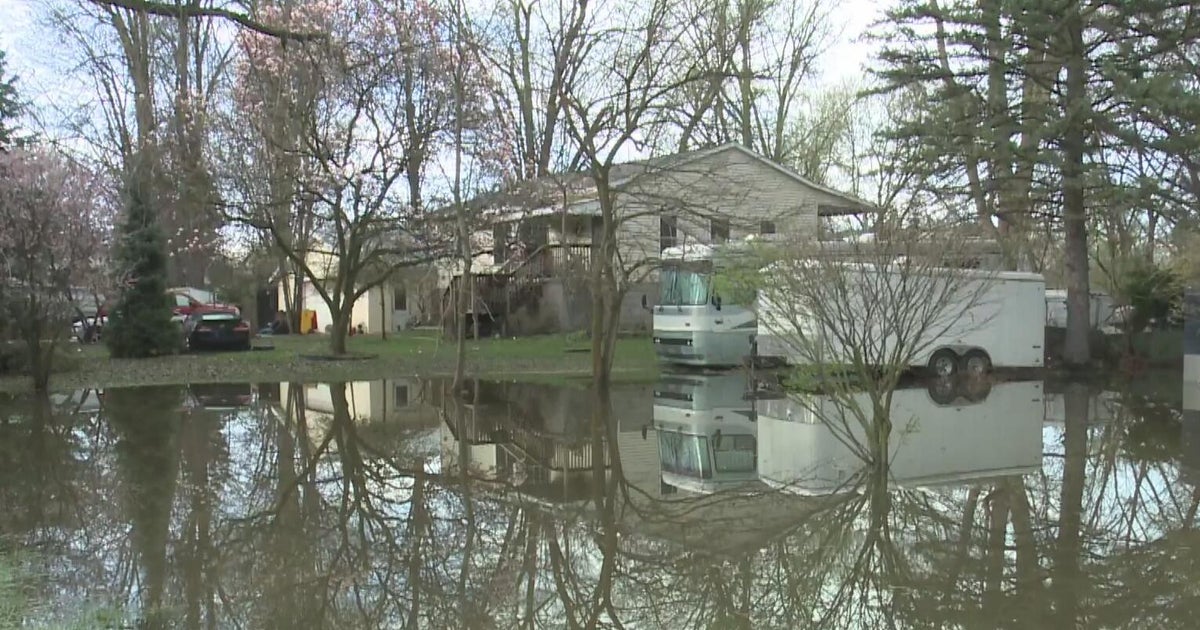
It has been a crazy day! Irene released her wrath over the region in the form of damaging winds and torrential flooding rains. While we actually received some emails that stated it wasn't much of a storm, I have to say that it was about as bad as I want to see it. We can be very thankful that we were not pummeled by a stronger hurricane. All of us in the WBZ Weather Center are very pleased that Irene behaved pretty much as advertised over the past few days. The rainfall ranged from anemic over southeastern MA and especially Cape Cod to prolific over western and parts of northern New England. Serious flooding is underway in many locations out there. Meantime, the only aspect of the storm that did not verify was the magnitude of the South Coast storm surge this evening and that is a good thing. Irene's whipping winds of 40-60 mph were widespread except in sheltered low-lying locations. Peak gusts to hurricane force occurred in a few locations mainly along the South Coast. Check out this storm summary from the National Weather Service.
WBZ-TV's Barry Burbank and Todd Gutner have the WBZ Forecast:
After paying some dues today, we will see the blues over the last three days of August into the first three days of September. Yes indeed, we will be rewarded with some beautiful weather featuring blue sky and plentiful sunshine most of this week. There is a risk of patchy cloudiness and a low risk of spotty showers on Thursday with a much greater risk of showers and a few storms next Sunday. As the decaying Irene departs, a mass of refreshing air will flow in and shove the high humidity out to sea overnight. The nice dry air will last most of the week with muggier conditions returning briefly over the Labor Day Weekend. Can you believe that it is here already? Expect daytime highs in the upper 70s to lower 80s except mainly middle 70s at the beaches Wednesday through Friday. Overnight lows will dip into the lower to middle 50s except a bit over 60 in Boston. If you are going to enjoy the beach this week, please be cautious in the ocean. There will be a very high risk of dangerous rip currents thanks to the large waves created by Irene. It will take at least a couple days for the sea to calm down.
Now that Irene is fading out of the picture, we will be closely monitor other potential developments in the tropics as we approach the peak of the hurricane season on September 10. Newly-formed Tropical Storm Jose with top winds of 45 mph will fizzle in the next day or so not far from Bermuda. Another suspicious area about 400 miles south of the southern Cape Verde Islands is becoming more organized and conditions are favorable for this disturbance to strengthen into a tropical depression in the next couple days. The next named storm is Katia. For more detailed information, log on to the National Hurricane Center.
Melissa Mack delivers her latest AccuWeather Forecast in the morning and Todd Gutner follows later in the day.
Make it a great week!