Eye On The Sky
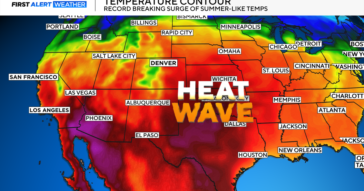
After the morning showers, it became partly sunny with a few widely scattered showers in eastern MA this afternoon. That action has waned but all eyes are focused on the outbreak of nasty boomers in northern New England. Unfortunately, this evolution is what I discussed in my blog Sunday evening. I continue to be concerned about a vigorous upper level disturbance that is digging southeastward from southern Quebec. It is destabilizing the atmosphere sufficiently to create some severe storms for the next few hours. A SEVERE THUNDERSTORM WATCH has been issued by the Storm Prediction Center in Norman, OK for a good chunk of northern New England until midnight. Extrapolation of these storms would bring the action into northeastern MA around 8:30 then into the Boston area shortly thereafter. We're praying that these storms will weaken and perhaps bypass the biggest celebration in Boston. However, this COULD be a very threatening situation for everyone especially the thousands and thousands of people on the Esplanade for the Boston Pops Fireworks Spectacular. Folks venturing out for evening activities anywhere up north and over eastern MA should keep an eye on the sky and be ready to find safe shelter. Some of these storms may contain damaging wind and hail, dangerous cloud to ground lightning, hail and torrents of rain. There are additional thunderstorm cells popping up behind the initial burst so it could be volatile until late evening. After that, it's all quiet with stuffy conditions and areas of fog.
As this upper level disturbance digs offshore, there will be a lot of residual moisture around tomorrow so expect some spells of sunshine but there will likely be lots of clouds with just a very low risk of a shower as the humidity decreases a bit. Temperatures will rise to about 85 or so with a sea breeze cooling off the beaches in the afternoon. As higher pressure builds to our south, the hotter air returns on a southwesterly breeze setting up on Friday. Along the coast, the gradient will probably be loose enough to enable sea breezes to develop again. Inland, it will nudge 90. Beyond that, there is an increasing risk of volatile weather on Saturday as several perturbations in the jet stream race east-southeastward from the Great Lakes and southern Ontario toward New England. These impulses will work on the hot and humid air in place and create the threat of more severe weather in various locations during the day. Once this action exits late in the day, a refreshing air mass will build southward from Canada and all signals are flashing fantastic weather through much of next week. Each day will feature a mix of clouds and sunshine with highs mainly in the range of 80-85. There could be a brief sprinkle or light showers Monday and a few potty showers on Thursday but no big boomers and no hot and humid weather is expected from the new pattern .
Stay apprised of updated forecasts for the potential storms this evening and enjoy the rest of the vacation week.
Melissa Mack delivers her AccuWeather Forecast in the morning and I shall follow later in the day subbing for Todd Gutner.