Extreme heat wave in Boston area as hottest weather in years could break records in Massachusetts
The heat wave has begun in Boston and across Massachusetts.
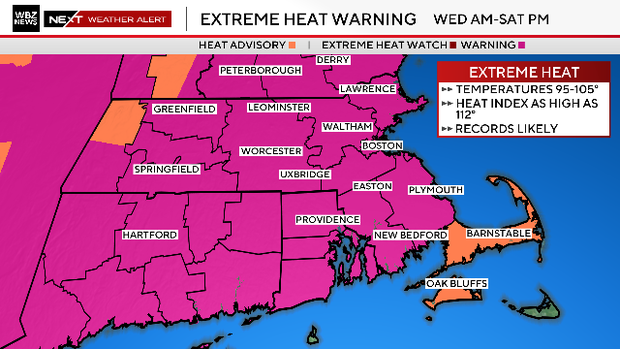
The WBZ Weather Team has issued a NEXT Weather Alert through Saturday for temperatures that could exceed 100 degrees with feels-like readings close to or exceeding 110 degrees.
In addition, an Extreme Heat Warning remains in effect for most of central and southern New England through Saturday evening.
The few exceptions are portions of the Berkshires, Cape Cod, and the Islands.
What is a heat wave?
A heat wave is three days in a row of temperatures at 90 degrees or above.
Some towns in southern New England could hit 90+ degrees for six consecutive days (Tuesday through Sunday). The last time we had a heat wave in the Boston area longer than 3-to-4 days was back in July of 2022.
The last time we hit 100 degrees in Boston was on June 24, 2025. That was the 28th 100-degree day in Boston's recorded history.
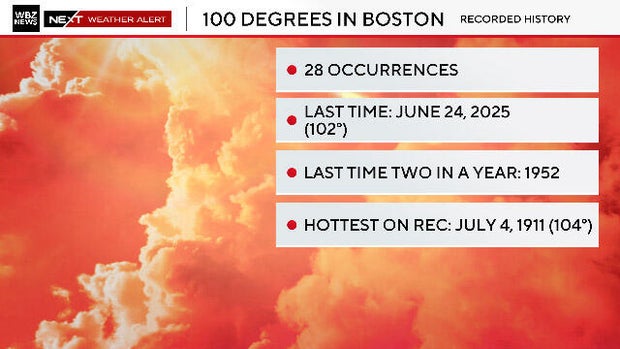
We will have multiple chances to reach or exceed 100 in the coming days. The last time Boston hit 100 on two consecutive days was back in August of 1944.
Boston weather forecast
Let's take a look at the forecast highs ahead.
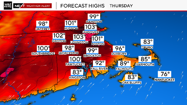
Thursday looks to be the hottest day of the entire stretch this week. Temperatures of 100 degrees will be well within reach in Boston and many suburbs. We are forecasting 98 to 104 degrees in most of Essex, Middlesex, Worcester, Suffolk and Norfolk counties as well as southern New Hampshire.
Add in the humidity and it will feel like 105 to 112 degrees.
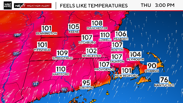
Thursday is our best chance of recording a new high temperature record in Boston.
Friday will be a very similar day to Thursday with most towns reaching 98-102 degrees
Feels-like temperatures will range from 105 to 112 (again).
We are forecasting a new record high temperature in Boston on Thursday and a tie on Friday. Those records were set way back in 1963 and 1911 respectfully.
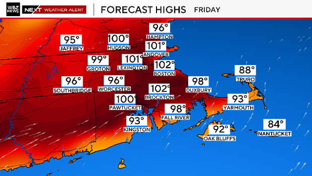
The last time we hit 100 in Boston was on June 24 of last year. That was the 28th 100-degree day in Boston's recorded history.
We will have multiple chances to reach or exceed 100 in the coming days.
The last time Boston hit 100 on two consecutive days was back in August of 1944.
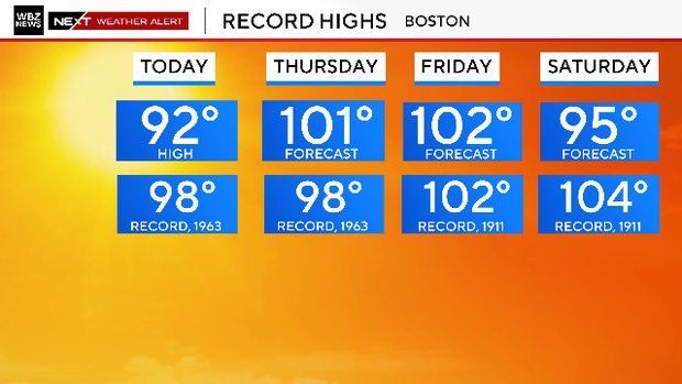
The heat eases just a bit on Saturday with highs generally in the mid 90s.
There is a chance of some afternoon relief along the Coastline in the form of a seabreeze.
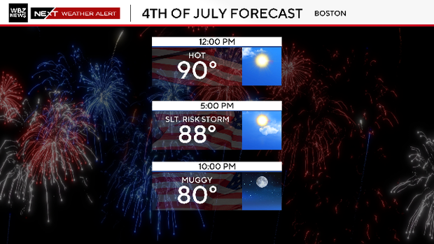
There is an isolated thunderstorm risk each day from Friday through Sunday, mainly in the afternoon and evening. It's hard to pinpoint the exact where and when, but something to be aware of if you have outdoor plans in the days ahead.
Boston weather radar
You can track any thunderstorm activity on our radar here:

With many folks heading to the beaches this holiday week, it is important that you recognize the signs of heat stroke.
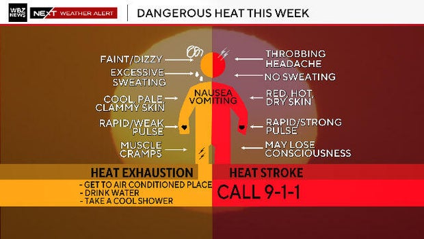
Stay hydrated and check on those who don't have access to air conditioning.
The heatwave will end on Sunday as highs will drop back in to the 80s. Open the windows back up next week. Highs on Monday and Tuesday are expected to be in the 70s with some refreshing, cooler nights.