Severe thunderstorms could bring heavy rain, damaging winds to Boston area Tuesday, weather forecast shows
The WBZ Weather Team is highlighting Tuesday afternoon and night with a NEXT Weather Alert for the Boston area with the risk of some heavy downpours and isolated severe thunderstorms.
Clouds started to arrive early Tuesday morning in Massachusetts along with a more humid airmass.
We are tracking the potential for a few rounds of heavy rain and thunderstorms beginning Tuesday afternoon.
Massachusetts Weather Radar
The Storms Prediction Center has placed most of central and eastern Massachusetts in a "marginal" risk of severe weather on Tuesday. The atmospheric setup will not be conducive to widespread severe weather in southern New England. There is a much higher risk across portions of New York State and the mid-Atlantic.
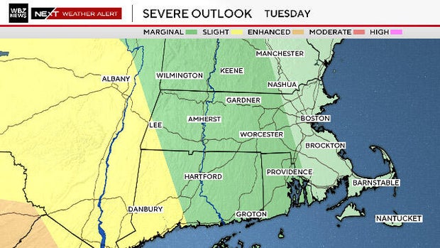
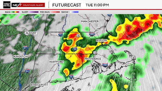
There may be some spotty showers early in the day on Tuesday, but most models indicate the first impactful weather to arrive between 4 p.m. and 7 p.m.
This is likely to be in the form of scattered, heavy downpours, and some embedded thunderstorms.
The Boston Red Sox game tonight at Fenway Park is certainly in jeopardy of being impacted.
Storms possible again on Wednesday in Massachusetts
There may be another round of soakers and storms late Tuesday night and one final storm chance when the cold front arrives during Wednesday afternoon.
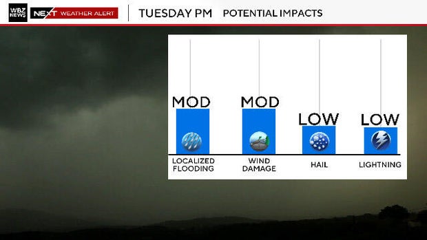
Main potential impacts for our area including scattered downpours, localized flooding and some isolated, straight-line wind damage.
Rainfall totals will vary greatly from place to place with some areas receiving 1-to-2 inches or more and others next to nothing.
Once the front passes through on Wednesday, the sunshine and drier air will return for the end of the week and likely last through the upcoming weekend.


