Flash Flood Watch For Southeastern Massachusetts Until 2 PM
BOSTON (CBS) - After a wild night of severe weather Monday on Cape Cod, including one thunderstorm that prompted a tornado warning in Barnstable County, our risk of damage is not over yet.
An isolated strong to severe storm is still possible on Cape Cod until about midday Tuesday.
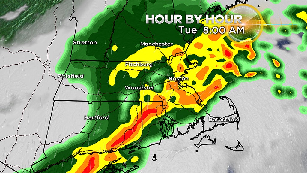
A flash flood watch has been issued for southeastern Massachusetts until 2 p.m. Heavy downpours and rainfall rates of 1-to-2 inches per hour will result in the risk of flash flooding in these areas. Additional rainfall amounts of 1-to-2 inches are likely, with some locally higher totals.
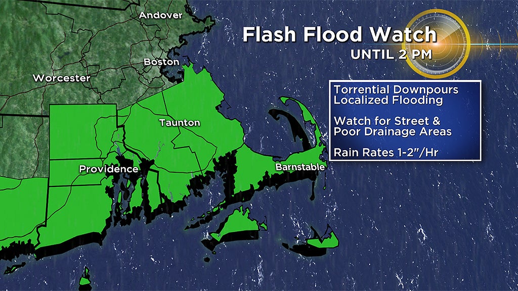
Remember when you're driving, if you see a flooded road - "Turn around, don't drown!"
Overall, a drying trend will take over from northwest to southeast during the afternoon. Expect temperatures to stay pretty steady too – only in the 60's to lower 70's Tuesday. After that, an expansive areas of high pressure will take over and provide us with a mainly dry stretch and warming trend through the end of the week and the weekend.
Next week looks hot!
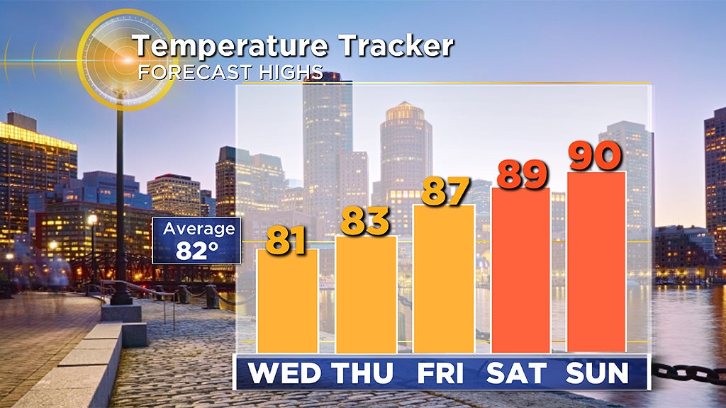
A heat wave is likely, and could last for several days in many inland cities and towns, perhaps even Boston too.