Two Storms Will Bring Ice, Snow To New England This Week
BOSTON (CBS) - It's not too often in winter that folks in Texas are looking longingly at New England with regards to cold and snow. This would be one of those times. As parts of Texas and the Deep South "dig out" from as much as 4-10" of snow (at least check there was 4" in Dallas and Houston, and 10" in the Little Rock, Arkansas area), we here in New England are preparing for some ice and rain. How about that??
So, how on Earth are the Gulf Beaches of Texas getting snow while our local Coastline gets rain? You can trace the roots for this historic cold and snow back about a month ago. You may remember me or other meteorologists discussing the "sudden stratospheric warming" that began back in mid-January? Well this global event was essentially the atmospheric bowling ball that is still knocking down pins some 4-5 weeks later. As temperatures were rapidly warming in the stratosphere over the Arctic, the typical bitter cold over the Pole was displaced and the "Polar Vortex" began to fan out and push south into the mid-latitudes. When something of this magnitude occurs, you look for severe winter weather to occur in the following 4-8 weeks. It could be in Europe (check)…it could be in Asia (check)…it could be in North America (adding check to that box now)…or it could come to all of the above at varying times (one last check).
Essentially, what we are seeing is a lobe of the Polar Vortex breaking off and sliding all the way south into Texas. Nine times out of 10 if you get that kind of cold in the mid-section of the country, eventually it finds its way east to our region. And, while we will likely get a bit of snow and cold later this week, we won't ever see the type of anomalous winter weather that is going on now in the Midwest and South.
Why? Well, you can likely thank La Nina (yes that is still going on), which tends to make for a strong "southeast ridge". In other words, warm air over the southeastern U.S. is fighting back and resisting the harsh cold from flooding eastward. Temperatures at 3pm on Monday afternoon illustrate this quite well…12 degrees in Dallas, TX and 85 degrees in Orlando, FL. When you get temperature gradients like that, crazy weather tends to occur!
So, back to New England, we find ourselves in the middle of this warm vs cold battleground. Not cold enough for snow (yet) and not warm enough to let our guard down either. The atmosphere always wants to rebalance itself and find an equilibrium, I mean it can't stay that cold in Texas for long…and, to achieve that balance, we get storms. Two of them to be precise.
STORM #1:
Our first storm arrive afterd midnight Monday night. There was some light snow and ice out ahead of the storm Monday evening, but this was largely nuisance-type stuff with no accumulation or real hazards to be concerned with.
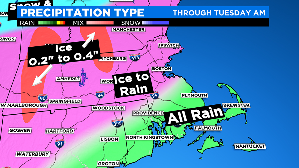
After midnight, the radar began to fill in. We saw greens (rain) across southeastern MA, pinks (sleet and mostly freezing rain) west of I95, and blues/whites (snow) in central and northern New England. Between 1 am and 5am Tuesday morning, the warmer air gradually won out and the rain pushed farther and farther inland.
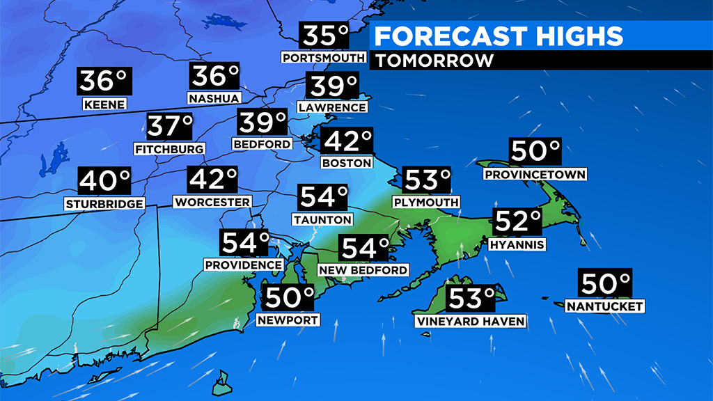
By the time most of us woke up (between 5a-7a), it was warm enough for plain ol' rain in all of southern New England with the exception of the Worcester Hills and Berkshires (elevation). These areas will hang on to the last bit of cold air and will be the final spots to reach above 32 degrees.
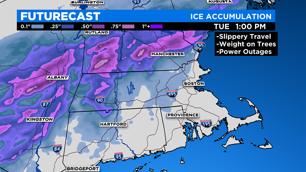
Therefore, in those areas, we are forecasting the best chance for a significant ice accretion, something on the magnitude of .25-.50". This is right about at the threshold where you start seeing tree and wire damage. THIS WILL NOT BE A MAJOR ICE STORM, but, there may be some isolated downed limbs and outages in northern Worcester County, southwest New Hampshire and in Western MA.
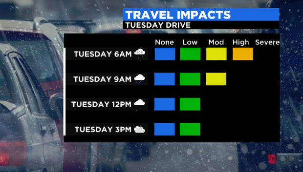
By late morning, the ice and rain will taper off and the last bit of cold air will be scoured out. Temperatures will top out well above freezing in the afternoon, milder the farther south and east you go. It won't be until well after sunset that colder air comes back and we refreeze. Overnight, any untreated surfaces that are still wet will certainly become slippery.
STORM #2:
We will wait another 24 hours or so before really digging in on this one. But I think we can say with a good deal of certainty that storm #2 will be quite different from its predecessor. We will be starting off with a much colder airmass in place, therefore it will start as all snow. This looks like one of those "front-end thumps" of snow that we get so often in wintertime here. About a six hour period of snow which drops a quick 3-6" across most of the area before milder air starts being introduced into the storm system.
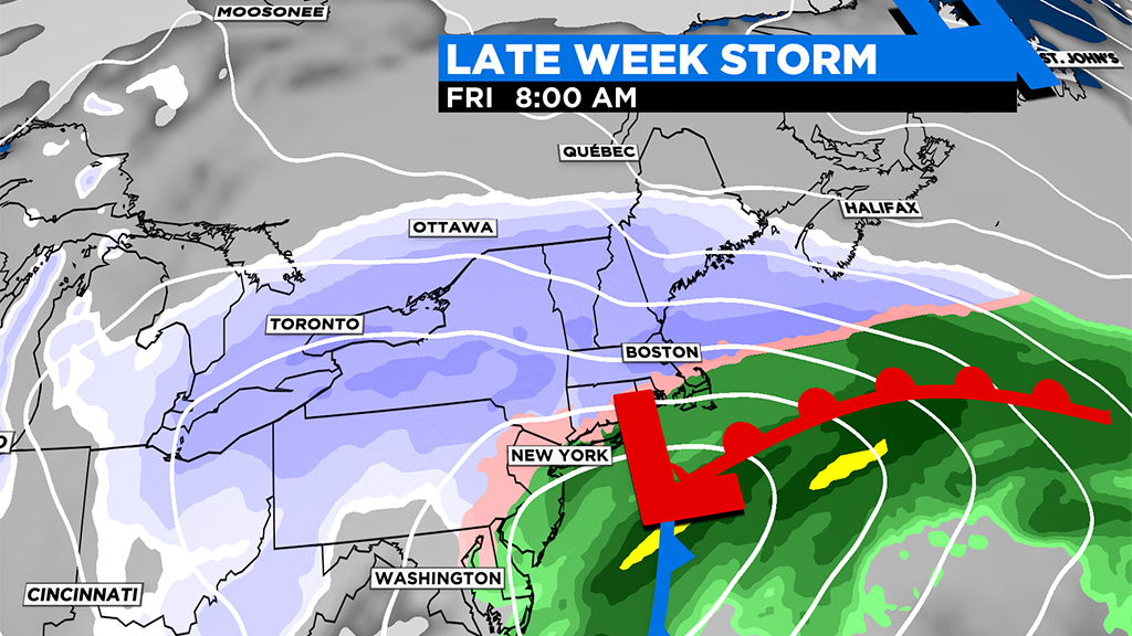
The timing for this snow looks to be Thursday evening into the overnight. By Friday morning, we will likely see some mixing or change to rain close to the Coast. Storm #2 will be another fast mover. By late morning Friday, whatever is falling from the sky should already be tapering off.
Again, stay tuned Tuesday/Wednesday for more detailed timelines, snow amounts and rain/snow lines!
Looks like a dry and quiet Weekend to follow!


