WEATHER BLOG: Wet Weekend
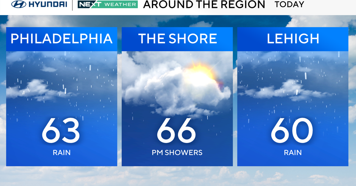
A stalled frontal boundary just to the north and a moist southerly flow over the region will provide for considerable cloudiness and scattered showers and thunderstorms today, and things do not appear to get much better any time soon. The frontal boundary will slip southward tomorrow and become stationary once again, this time right over the area, as an area of high pressure builds southward from the Canadian Maritimes into New England. With the frontal forcing and moisture from Tropical Rainstorm Isaac, we may have to contend with some hefty downpours in some of the storms. Model guidance projects precipitable water values in the neighborhood of 2.0 to 2.1 inches, and with a rather weak flow oriented parallel to the frontal boundary, this could mean training thunderstorms and a risk of flash flooding. Not the best Labor Day, that's for sure.
The risk for heavy rainfall should actually decrease a bit for Tuesday as the stationary boundary lifts northward as a warm front and we lose that focusing mechanism. That said, the atmosphere will remain very moist so localized flash flooding will remain a concern. Wednesday will remain unsettled as a wave of low pressure ripples eastward along the frontal boundary to our north, and with the moisture content remaining very high, the same song and dance is expected once more.
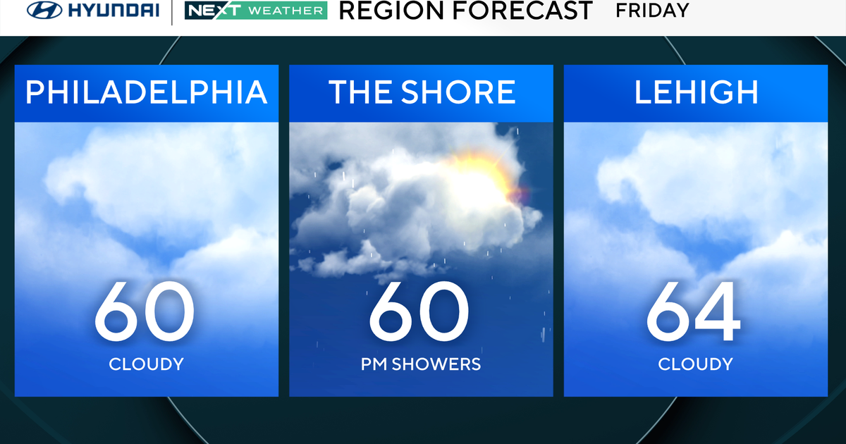
Some improvement is possible as early as Thursday with some of the model guidance projecting a cold front to move through… but the speed of that feature is in question. The better day of the upcoming week will likely be on Friday as all of the available guidance pushes the front through by that point with drier air building in.