WEATHER BLOG: Thunderstorms On The Way
Its been dry the past couple of days but today may be the end of that, with a broad trough approaching from the west in the upper levels and a weak surface trough interacting with plenty of moisture. This will result in a pretty active day for the northeast. A severe threat is even setting up across Central NY, Most of PA west of I-81, and down the lee of the Appalachians. As expected with instability based activity, the best activity will occur during the afternoon.
Perceptible Water Values are over 1.25 inches, and some localized heavy rain and flash flooding will occur west of the big cities, with the threat for some damaging winds and hail as you go even further west. For Philadelphia down through DC, the modeling is showing an area of less activity and subsidence, and therefor less activity. As a result the big cities and coast may have to wait just a bit longer for substantial rain. The modeling doesn't agree 100% on how much rain falls tonight either, however it looks like it should continue in some capacity overnight, however without the continued instability amounts should come down as does the threat for severe weather and thunder.
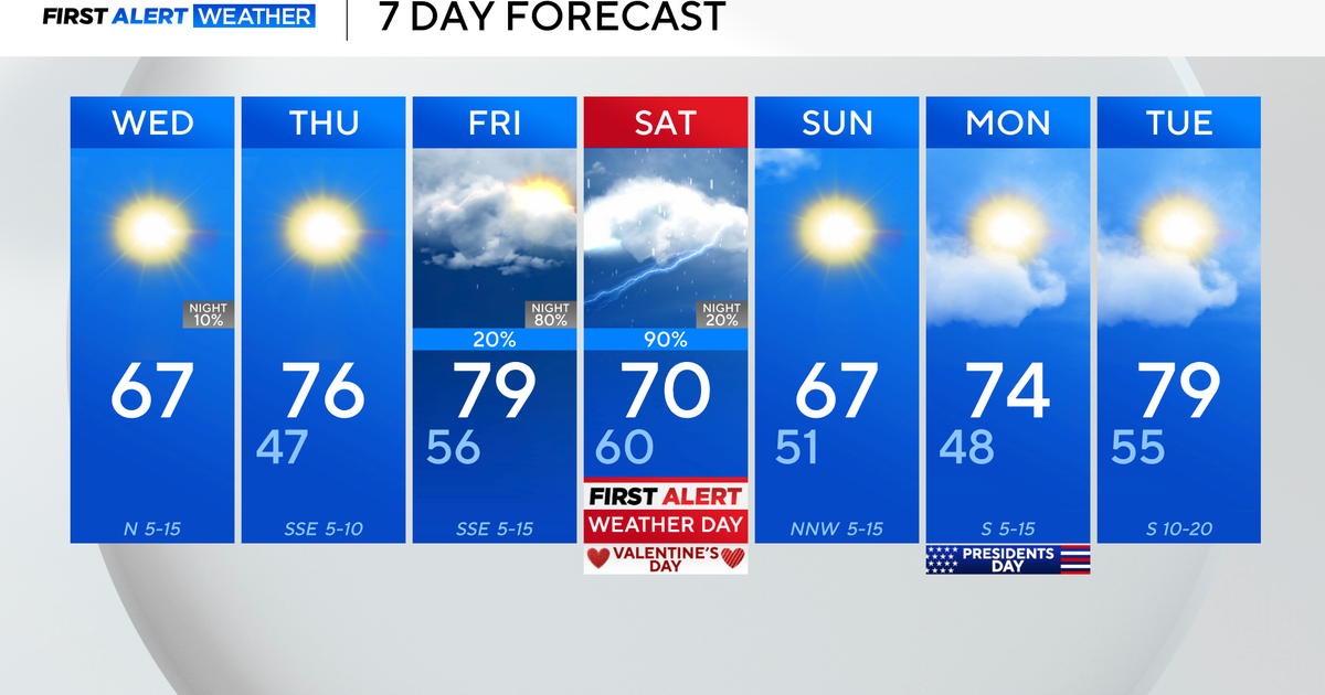
On Monday, heavy cloud cover and the now dampened ground should prevent much in the way of thunderstorms or severe weather. Instead, it looks like a good deal of rain should cross the region, with perhaps and embedded thunderstorm in the mix. Rainfall amounts will be the most consistent and most widespread on Monday out of any day in the forecast. All the cloud cover will keep us from getting as warm as today, however a southerly wind will keep us from falling too cool. Numbers have a significant range as they have for the past couple of days. Given the soaking rain possibility I am leaning towards the cooler side of things.
On Tuesday low pressure pushing off the New England coast will try to work down cooler and less saturated air. A bit of rain may linger early in the morning Tuesday, however by the afternoon conditions should improve, with the sun returning to some degree with conditions drying.
Wednesday through the end of the week looks quite nice, as high pressure sneaks in and produces some fantastic weather, with temperatures climbing back above normal on Friday. For the weekend, high pressure will unfortunately give way and allow for a disturbance to the southwest work in an perhaps provide for some unsettled weather
