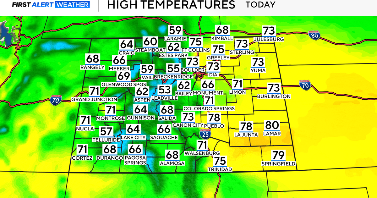
WEATHER BLOG: T-Storms Ahead
A warm, muggy and uncomfortable start early this Sunday morning with a warm/sticky air mass out ahead of a cool front which will cross the area Sunday evening and Monday morning. The front itself still extends back from western lower Michigan southwestward back into Oklahoma and the Texas Panhandle. Out ahead of it, we have the remnants of an MCS in western Pennsylvania, but this should dissipate long before making it to us this morning (or pass to our north)....so we will just see some remnant blow off high and mid level clouds from this complex move across the area. But, these clouds probably thin out or generally pass by to our north, so we expect a fair amount of sun later Sunday so we kept the 93 in for our afternoon high.
As far as shower/t-storm coverage , we do not expect much between now and 2-4 p.m. with the front still well back to the west. But as we head into the mid to late afternoon, t-storms should begin to develop across the area despite the front still being well back to the west, and these storms could trigger some severe t-storm warnings with damaging winds being the primary threat. If a more organized complex of t-storms can indeed reach our area, it likely would not be until Sunday evening , perhaps in the 8-10 p.m. timeframe. These potential t-storms could contain gusty winds, heavy rain and of course lightning. Hail and tornadic activity seem highly unlikely with little directional shear and the cooler air aloft/upper dynamics displaced too far to our north.