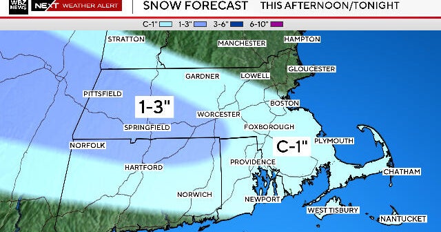
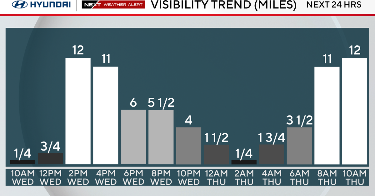
WEATHER BLOG: Spotty Showers
As high pressure remains the dominant feature in our weather pattern this week, we'll be keeping tabs on a series of weak impulses of energy moving through the Great Lakes and into the Northeast. Each one of these disturbances only has a small chance of producing spotty showers, especially in areas north and west of the I-95 corridor.
While the models do differ on their timing somewhat, our prevailing thoughts are that one of them will be moving through the Northeast's interior tonight, and then the next one will be doing so on Friday.
The axis of the ridge of high pressure should consolidate in the western Atlantic during the next 72 hours, and the flow on the back side of it will usher in some unusually mild air by the end of the week and weekend.