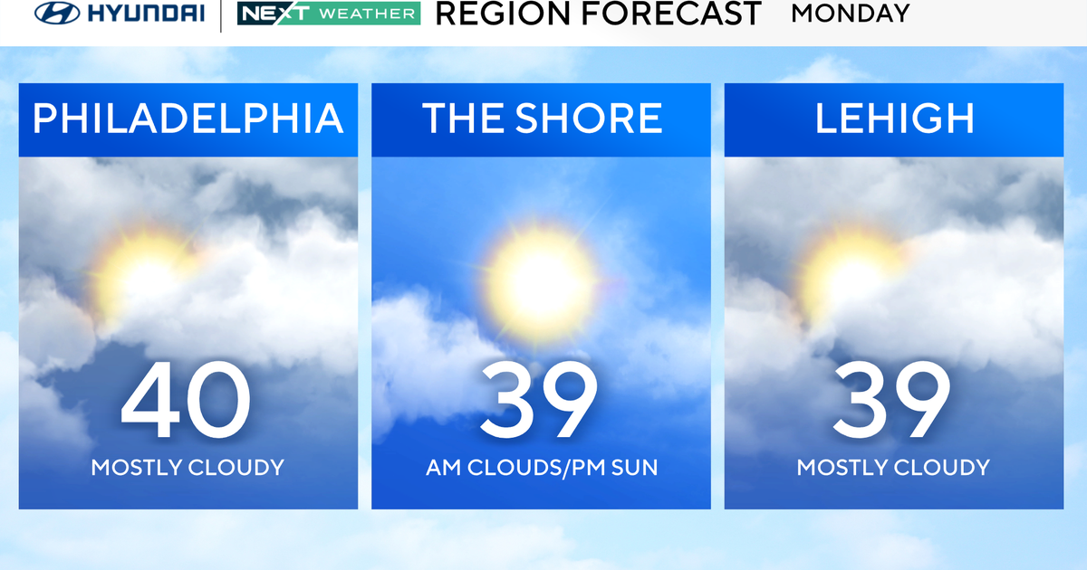
WEATHER BLOG: Rainy Wednesday Ahead
High pressure over New England has been holding the rain off to the south. Short range guidance continues to suppress the main shield of rain until 8-10pm this evening. One thing to keep in mind this evening is that there may be echoes showing up on radar, but the rain may not be reaching the ground until the low levels of the atmosphere really moisten up. The heaviest rain will fall tomorrow morning through the first half of Wednesday night. Most of the viewing area will likely see around 1" of rain with locally higher amounts possible. Later tomorrow and tomorrow evening, the instability increase ahead of the approaching front may cause a few rumbles of thunder in the late afternoon and evening. 3 hour flash flood guidance across the viewing area is around 3-4". It does not appear that widespread flooding will be a problem, but localized flooding is expected in low-lying and poor drainage areas. Also, something to note is with the leaves on the ground, slippery travel is possible. The heaviest rain exits to the east later tomorrow night as drier air pushes in.