WEATHER BLOG: Chance For Rain
We have a weak disturbance that will be crossing the area Saturday as the humidity continues to climb. This will give us a shower from time to time, and perhaps some thunder as we head into the afternoon. The chance of a shower or thunderstorm will continue in the humid air Saturday night, then a strong disturbance will be moving through Sunday. This will again give us the chance of a shower or thunderstorm, especially for the afternoon and evening.
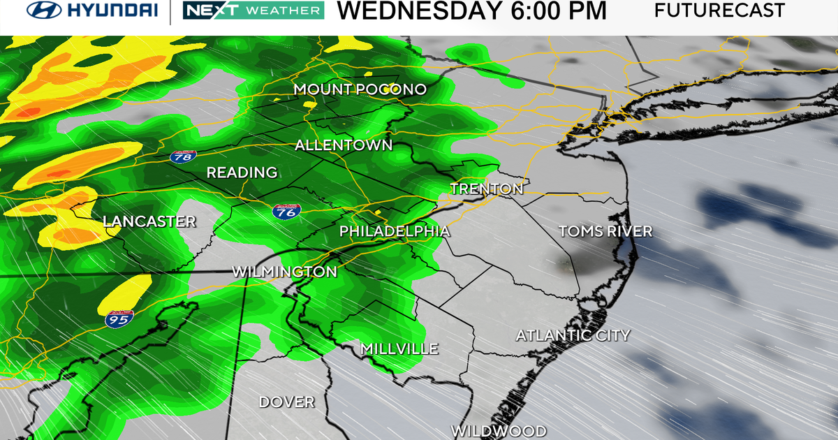
Monday will also have the chance of a thunderstorm, especially for the afternoon, as a trough lingers along the coast. Most of the time will stay rainfree, however. Tuesday will have a small ridge over the area, and so it should just be hot and humid - temperatures are likely to be back into the mid and upper 90s with a strong push of hot air into the region. Wednesday will probably be just as hot ahead of a front that will move across the Great Lakes and into Pennsylvania by the end of the day. We could see thunderstorms arriving during the day, but they are most likely late in the day and into the nighttime hours. Some of those storms could be severe as that strong front moves through.
The front will still be in the area Thursday, though mostly to our south. This should mean the humidity will come down some for the afternoon and it won't be as hot as Tuesday or Wednesday. Very comfortable conditions will be around for the end of the week.
Have a great day!