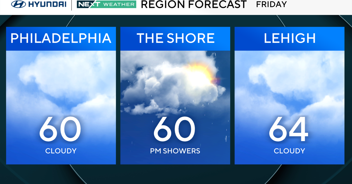
WEATHER BLOG: Labor Day Weekend
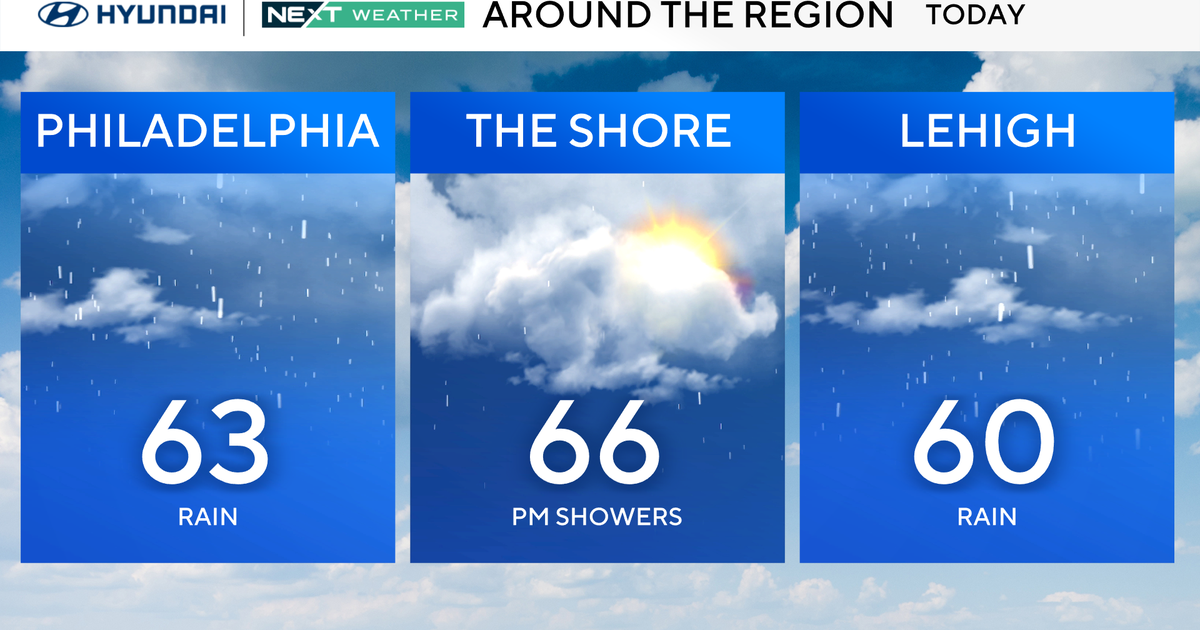
Today will be the best weather day of the extended Holiday weekend. A dry cold front will be pushing from north to south today. Despite that front dropping southward, we are still in for warm temperatures today and we are off to a warm start this morning and the wind will stay mainly out of the northwest to north with a mixture of clouds and sunshine. The moisture and being pulled eastward coming from the old Isaac system spinning out over Missouri ahead of the front dropping southward will be enough to result in a stray shower or thunderstorm this afternoon and evening. We are concerned for tonight for the set up of low clouds. This takes place on a more northeast to east flow of the ocean behind the front tonight and tomorrow morning coming around high pressure that sets up over Nova Scotia. Meanwhile, the front that moves southward today will set up tomorrow down over southern Virginia or northern North Carolina. So in addition to the low level moisture that may make for an overcast morning, we will also have some mid and upper level
moisture being directed up and over the front in the southerly flow aloft well in advance of the remount Isaac low as it moves toward southern Indiana. So again tomorrow some wet weather becomes likely tomorrow midday or afternoon.
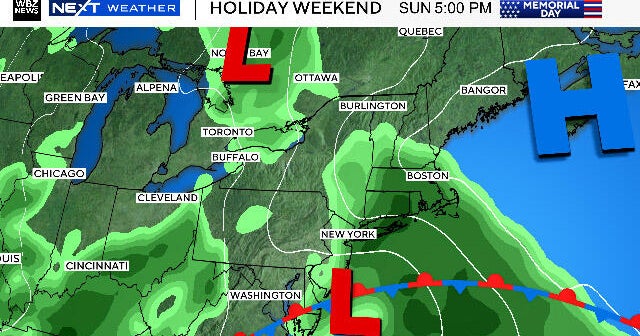
A new high pressure center, that will be up over western Quebec tomorrow morning, will try to replace tomorrow's Nova Scotia high. However, at the same time, the Isaac weakening remnant low will continue to move slowly eastward and more moisture will be coming up and over the front still down to our south. So we are apt to see wetter weather Monday. With the east or southeast stable flow from the Ocean to the north of the warm front, we expect just showery weather and perhaps an embedded thunderstorm Monday. Plenty of clouds too for Monday. On Tuesday, the weakening Isaac low and a weak cold front will try to come through. That will spell the good chance for at least a shower or thunderstorm Tuesday and Tuesday night, and perhaps some pockets of heavy rain in the showers and thunderstorms. This front will stall nearby Wednesday and may rekindle with a few showers and thunderstorm Wednesday. A front coming into the northern Rockies today will have a front that tries to move through Thursday, resulting in another chance for a shower or thunderstorm. Thursday does not look as wet as Tuesday and perhaps Wednesday have the potential to be, as a fast westerly flow in advance of the front may help send most of the moisture eastward well in advance of the Thursday front. The front does not have much upper level support either. Dry, less humid and a little cooler weather is slated to follow Friday and Saturday.