Temps Dropping, Snow And Ice Possible Tonight, Saturday
BALTIMORE (WJZ) -- Snow is possible Friday night into early Saturday morning, and a wintry mix is possible later in the day on Saturday, according to WJZ Meteorologist Tim Williams.
The National Weather Service has issued a Winter Weather Advisory for most of Maryland, which will be in effect from 4 a.m. to 6 p.m. Saturday.
Snow, sleet and freezing rain is expected.
The Maryland Department of Transportation's State Highway Administration (SHA) is pretreating roads and bridges in advance of the forecasted storm.
Temperatures will fall throughout the day Friday, getting down to 29 overnight.
We could see some light snow late Friday night, leaving a coating for Saturday morning.
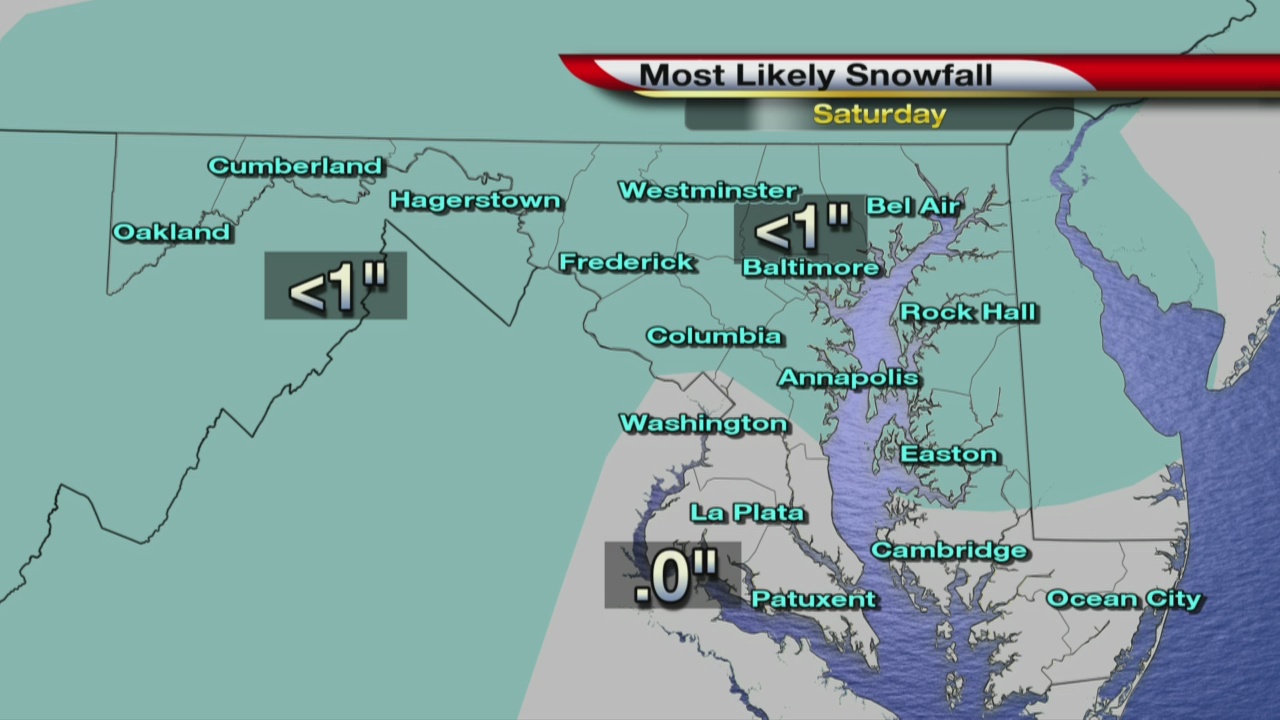
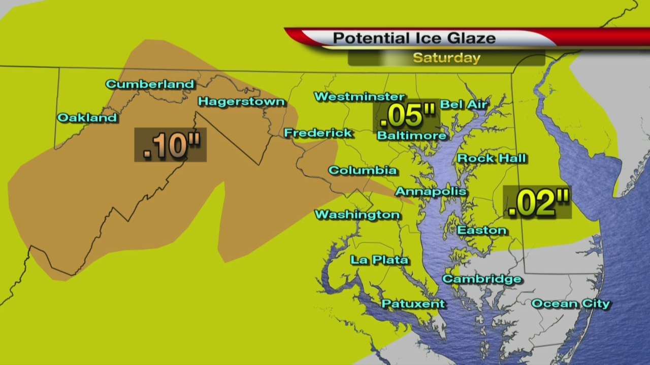
After that, a wintry mix could move in around mid-morning Saturday.
This is part of a narrow alley of storms that's causing big problems near Missouri.
Despite being a thin line, it's a couple hundred miles long, and a few inches of ice could fall in that area before all is said and done.
Problems here won't be nearly that severe, but Maryland could see sleet, snow and freezing rain from mid-morning through dinner hours Saturday.
Because the temperature in the area spiked to 70 degrees Thursday, however, the ground has warmed up and precip may not stick to the roads everywhere.
Check back with WJZ for the latest First Warning Weather forecasts. Download the mobile weather app HERE, or visit our weather page HERE.
Follow @CBSBaltimore on Twitter and like WJZ-TV | CBS Baltimore on Facebook