Winter Storm Watch & Warning Issued For Parts Of Maryland
BALTIMORE (WJZ) -- Winter storm watches and warnings will be in effect for parts of Maryland late Sunday into early Monday as snow could fall and accumulate over the next 24 hours.
At this late hour, we are watching a band of rain and snow that's breaking out several hundred miles to our southwest but is also moving towards the northeast. It's going to bring light rain later tonight, then after about 2 a.m., colder air will filter in changing rain to some wet snow and sleet for several hours.
Maryland is squarely in the path of this precipitation, which is expected to begin after midnight as a mix of snow sleet and light rain.
As of tonight, it appears there will be a very sharp snowfall gradient across Central Maryland. Along the Maryland Pennsylvania border, amounts may only be around an inch or two.
By 10 p.m., we expect temperatures to fall to around 44 degrees as a round of light rainfalls.
But by 1 a.m. Monday we expect temperatures to drop to 37 degrees, which is cold enough for wet snow to begin falling across the region. By 5 a.m., the air will be cold enough to support an all-snow event.
From that point through late Monday morning, snow will have a good chance to accumulate, especially on grassy surfaces as roads are still warm from the recent mild-weather days we've seen lately.
This is a very complex and still developing storm, but the potential is for a very nasty morning, with not only snow but gusty winds as well.
A Winter Storm Warning is in effect for D.C., parts of central Maryland and northern Virginia from 1 a.m. to 4 p.m. Monday.
Areas under the Winter Weather Watch include Baltimore City, southern Baltimore County, along with Anne Arundel, Calvert, Charles, Howard, Prince George's and St. Mary's counties.
Carroll, Cecil and Harford counties along with central Baltimore County are more likely to get 1 to 2 inches of snow, with western Maryland expected to miss out on any measurable snowfall.
If it snows hard enough and temperatures fall to 30 degrees by 7 a.m., then things can get pretty dicey rather quickly. This event will impact your morning work and school plans if the storm continues on its projected path toward our region.
The heaviest snow will likely fall south and east of Baltimore City, but across central Maryland we might see an inch or two of snow by the Mason-Dixon Line. Areas including Annapolis, the Eastern Shore and D.C. could get five to eight inches. Some of us might even see more than that.
Baltimore City can receive 3 to 5 inches of snow with only about 2 or 3 inches about 20 miles north and west. South of the city can reach 8 or 10 if everything comes together.
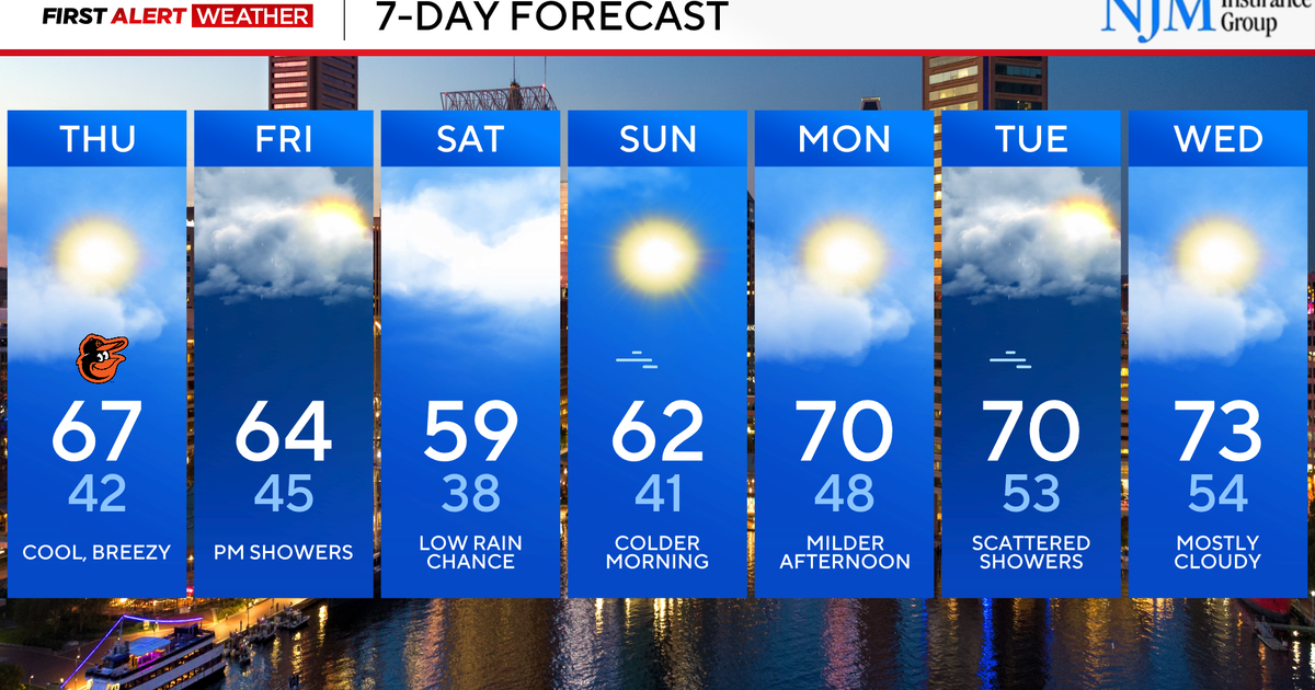
The forecast calls for much colder air on Monday as the day goes on, meaning we expect any snow that falls to stick around for a few days as a result.
Cold air will drop temperatures back into the upper teens on Monday night, with colder wind chills.
Winter weather advisories are in effect from Baltimore north and west, but a winter storm warning is in effect for areas south and east of the metro area where the heaviest snow will likely fall.
