Maryland Weather: Areas of fog ahead of a cloudy Wednesday
BALTIMORE -- It will be partly to mostly cloudy overnight with lows near 40 degrees.
Some patchy dense fog will develop late Tuesday and will last through the morning commute on Wednesday.
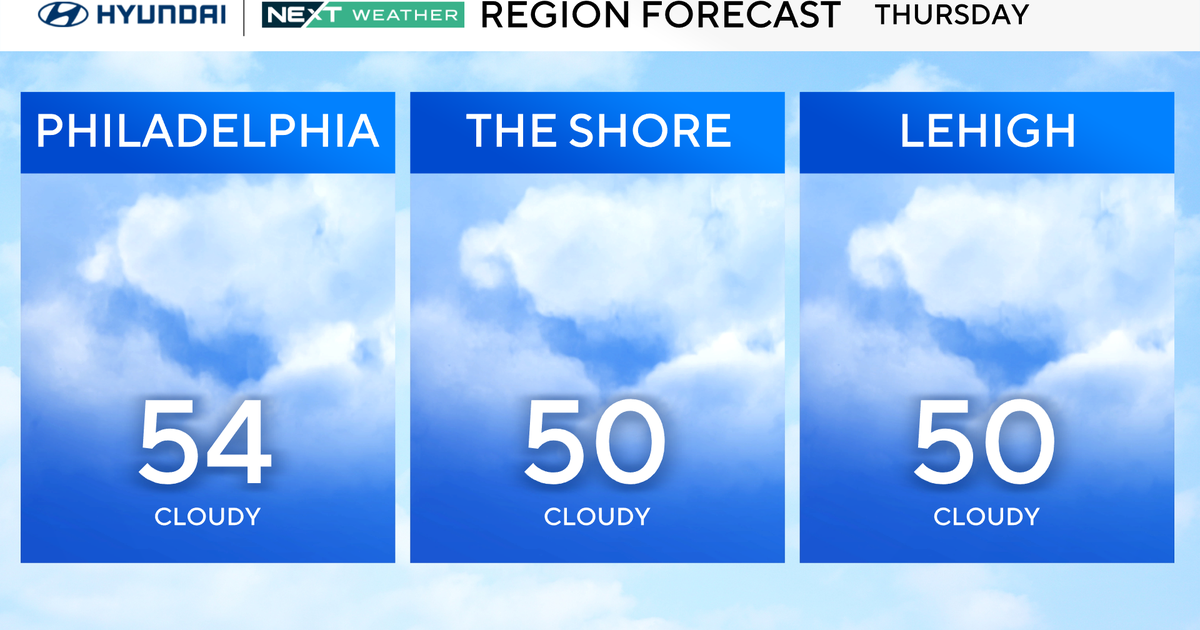
Temperatures will rebound on Wednesday afternoon with temperature highs in the mid-50s. The skies will continue partly to mostly cloudy across the area.
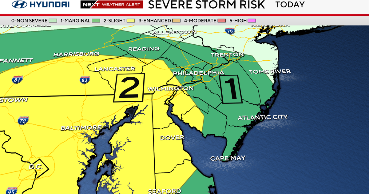
Mostly cloudy skies will return to the area Wednesday night as the next storm system approaches. Rain chances will increase in Western Maryland late Wednesday night and spread across the rest of the area during Thursday's daytime hours. Thursday is projected to be a wet day with showers likely lasting into the night.
Rain chances will linger especially east of I-95 early Friday before tapering off. Upslope snow showers can be expected for far Western Maryland into Friday afternoon. It will be breezy and cooler in the wake of the storm system with highs on Friday again in the mid to upper 40s.
Saturday will be dry with temperatures in the 40s and partly to mostly cloudy skies. Another storm system will move into the area Sunday with a chance for rain that will last through early Monday morning.
Temperature highs on Sunday will reach the upper 40s with lows at night in the mid-30s.
It will be breezy and chilly on Monday. Temperature highs will reach the 40s but it will feel colder with the gusty westerly winds. Any rain chances on Monday should end by mid-morning. It will likely remain mostly cloudy through the day.