BLOG: Wall-To-Wall Sunshine
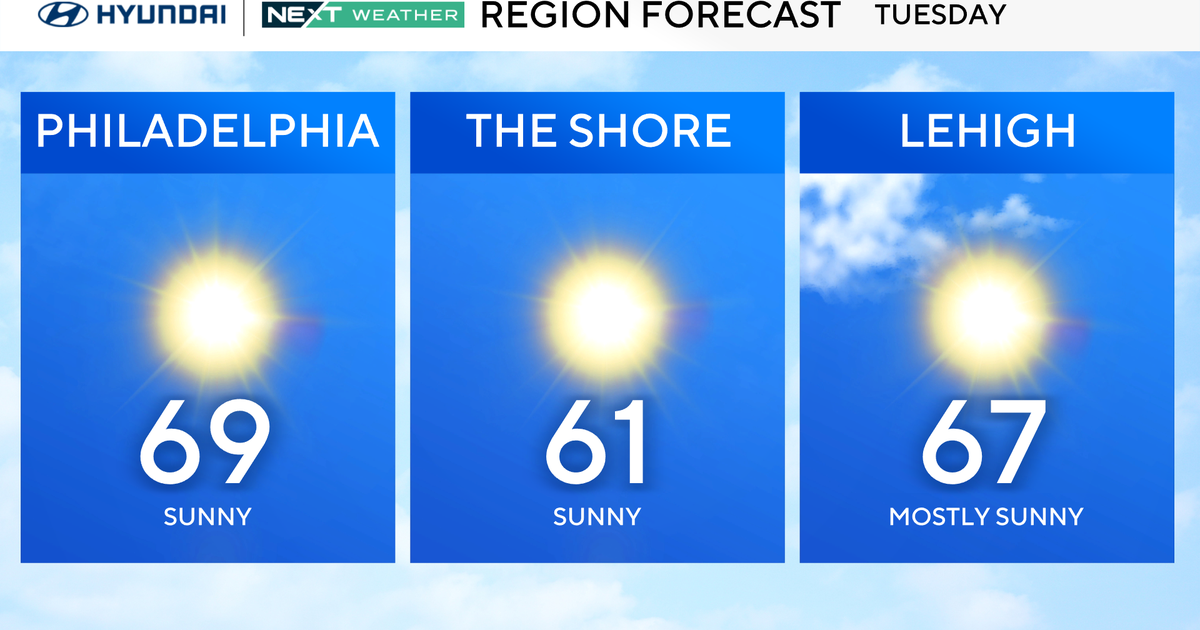
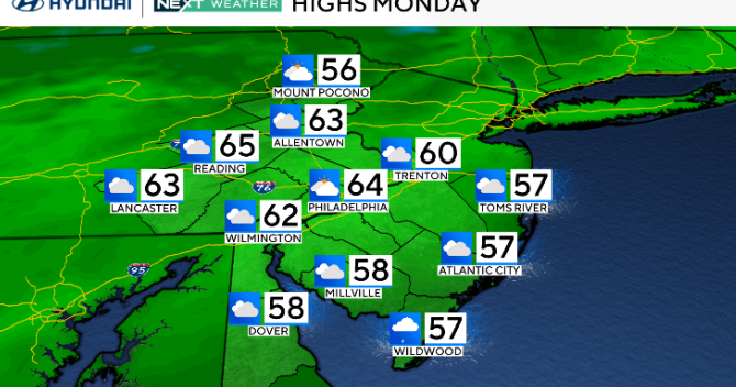
That freeze warning was warranted late Monday night/early Tuesday morning. Even though the city only dropped to 37 degrees, BWI-Marshall bottomed out at 31 degrees with many places north and west of the city down in the 20s. With wall-to-wall sunshine Tuesday, we recovered to 56 degrees. Yes, that is way below where we have spent most of the month, but it's still only 2 degrees below the rising average of 58 degrees. Just like every cold push of air this season, it will be short-lived with warmer air arriving Wednesday
The push of warmer air will come ahead of the next cold front. Temperatures will jump back to the low 70s Wednesday afternoon. At the same time, there will be some more clouds and scattered showers/thunderstorms later. The showers could linger into Wednesday night before the front gets out of here Thursday morning. Cooler air will follow this front, although highs will only drop into the 60s Thursday and Friday afternoons - still above average.
We will be watching for another front to move our way Friday night/Saturday. Temperatures will swing up and down with these fronts passing through, but they will still be close to or above average through the weekend at least.
**You can now follow us on Twitter and Facebook at WJZ First Warning Weather.
ATTENTION TEACHERS, STUDENTS, AND PARENTS: Our Weather Field Trip Day at Camden Yards is coming soon. The fun-filled day is set for Wednesday, May 23. Get your tickets now. Click here for more information.