Another Alert Day for Thursday across Maryland
A stretch of active and oppressive summer weather is on tap for Maryland, beginning with a threat for severe storms Thursday and transitioning to a prolonged period of dangerous heat through early next week.
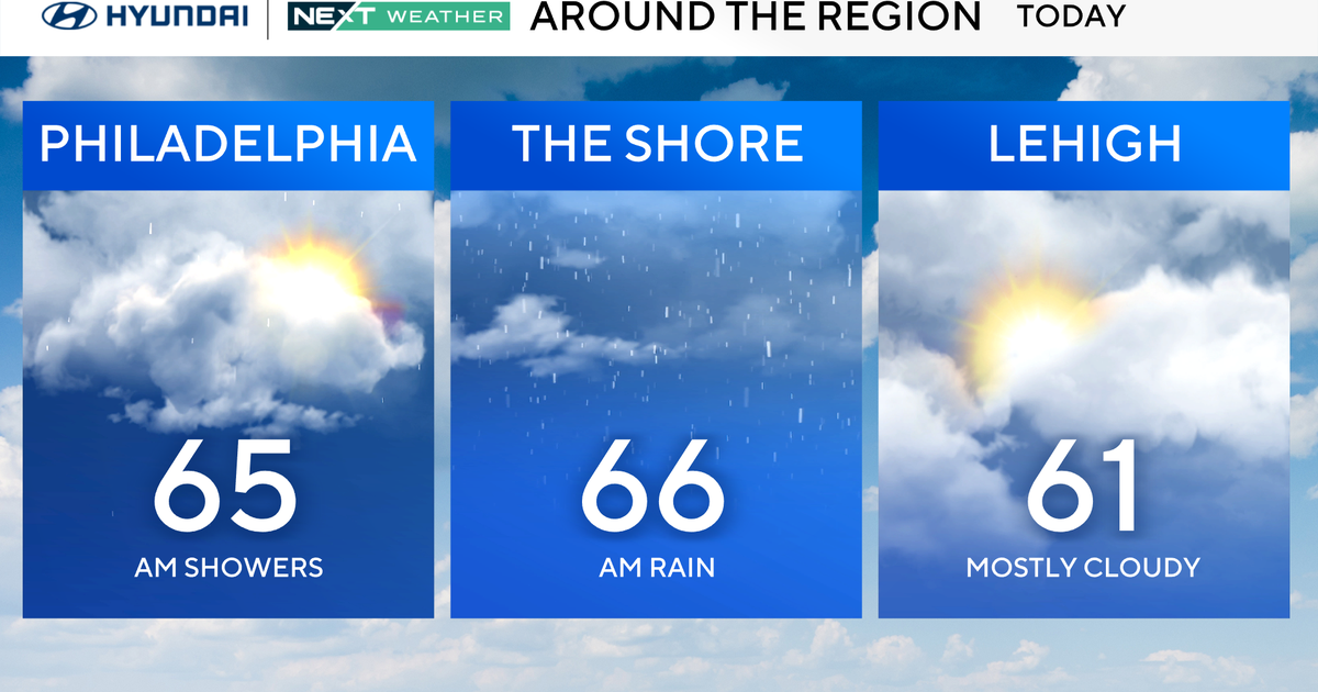
Overnight tonight, skies will be partly cloudy with high humidity lingering. Patchy fog may develop in low-lying and sheltered areas by morning, especially near bodies of water. Temperatures will remain warm and muggy, with overnight lows settling in the low 70s.
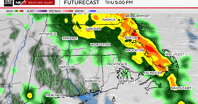
Thursday begins with a mix of clouds and sunshine, but the weather will quickly turn active. A First Alert Weather Day is in effect as a cold front approaches from the west, setting the stage for widespread thunderstorms during the afternoon and evening hours. Some of the storms could be severe.
Any storm that forms will be capable of producing damaging wind gusts, large hail, torrential rainfall, and frequent lightning. There is also a small chance for an isolated tornado, particularly in areas that see sustained sunshine ahead of the front, which could lead to stronger storm development. The severe weather threat will persist through the evening commute before gradually ending as the front pushes south of the region Thursday night.
Behind the front, slightly drier and cooler air will filter into the region. Humidity levels will drop, offering temporary relief, and Thursday night temperatures will fall into the mid to upper 60s under clearing skies.
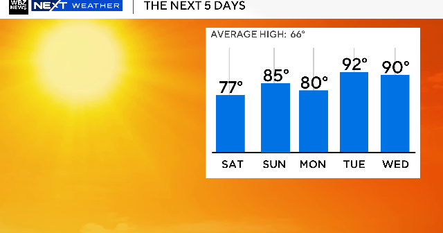
That brief break will be short-lived. By the weekend, a surge of intense heat will build into the region, just in time for major outdoor events like the AFRAM festival in Baltimore. Highs on both Saturday and Sunday will rise into the low to mid-90s, and when combined with elevated humidity levels, heat index values could climb to near 100 degrees by Sunday afternoon.
Festival-goers are urged to take precautions, including wearing light-colored and loose-fitting clothing, seeking shade when possible, and drinking plenty of water. The combination of heat and humidity may pose a health risk, particularly for children, the elderly, and those with underlying health conditions.
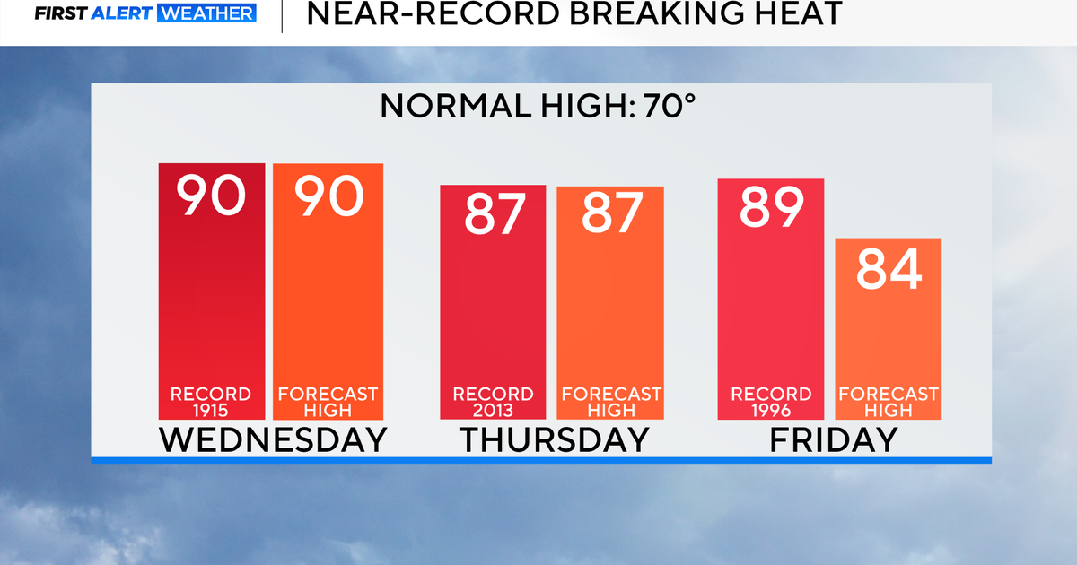
The real danger arrives early next week. A powerful upper-level ridge of high pressure will establish itself over the Mid-Atlantic, creating a multi-day stretch of extreme heat. First Alert Weather Days have been issued for Monday, Tuesday, and Wednesday as temperatures soar. Actual high temperatures will flirt with 100 degrees each day, and the heat index could easily exceed that threshold, making it feel even hotter.
Tuesday appears to be the peak of the heat wave, with some spots potentially experiencing heat index values above 105 degrees. These conditions could lead to heat-related illnesses if proper precautions aren't taken. Residents are advised to limit outdoor activities during peak heating hours, check on vulnerable neighbors, and ensure pets have access to water and shade.
Later in the week, the upper-level ridge will begin to weaken, allowing for slightly cooler - though still hot - temperatures in the 90s. As moisture returns to the region, so will the chance for scattered thunderstorms by late next week, offering a potential pattern change as July gets underway.
Stay with WJZ for continuous updates on the severe weather potential Thursday and the intensifying heat wave into next week.