National Weather Service begins surveying damage left behind from severe storms
Tornadoes ripped through North Texas on Tuesday.
Watch CBS News
Tornadoes ripped through North Texas on Tuesday.
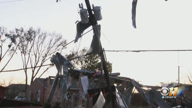
Hundreds of North Texans are working to assess the damage and replace what was lost in yesterday's storms.

The National Weather Service will be in the Collin County town of Blue Ridge tomorrow to survey damage left behind from a tornado that touched down early Tuesday.
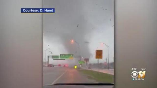
A violent tornado seen crossing Highway 114 caused significant damage just down the street from Susan Ocon's home.

The National Weather Service will be in the Collin County town of Blue Ridge tomorrow to survey damage left behind from a tornado that touched down early Tuesday.
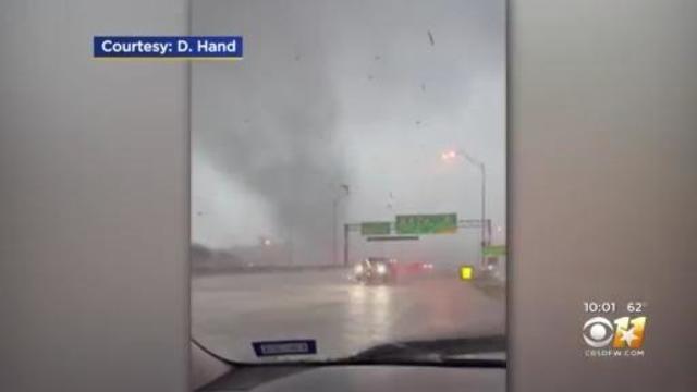
A violent tornado seen crossing Highway 114 caused significant damage just down the street from Susan Ocon's home.

In what became a very different experience during the morning commute, a driver along State Highway 114 in Grapevine spotted a funnel cloud spinning their way.

Severe storms ripped through North Texas on Dec. 13.

Grapevine police stated they have confirmed at least five injuries related to Tuesday's storms.

Some rain late tomorrow night is possible, but the real story moves in Tuesday morning.
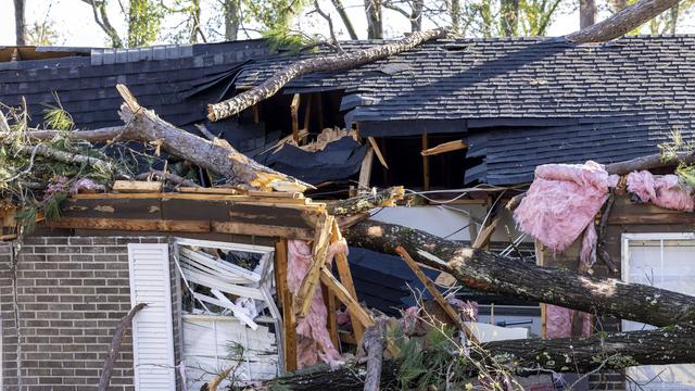
More than 50,000 customers in Mississippi and Alabama were without electricity Wednesday morning, according to poweroutage.us, which tracks utility outages.

Following the severe weather in North Texas Friday, the National Weather Service has spent the weekend surveying the total damage done by tornadoes.

Law enforcement officials said two of the 10 people injured were in critical, but stable condition at Paris Regional Medical Center.
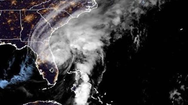
It made landfall over southwestern Florida as a major Category 4 hurricane and, while downgraded, was still packing a powerful punch overnight.
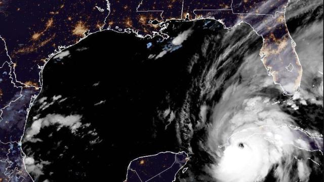
The powerful storm hit western Cuba early Tuesday, and is expected to strengthen even more before dealing a blow to Florida's west coast.

The storms tore through an East Oak Cliff apartment complex this evening, blowing off chunks of the roof of at least three buildings.
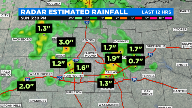
As of 3:45 p.m., 121,422 power outages have been reported across the Metroplex.

Governor Greg Abbott has issued a disaster declaration for the 23 counties that were impacted by the historic flooding this week.
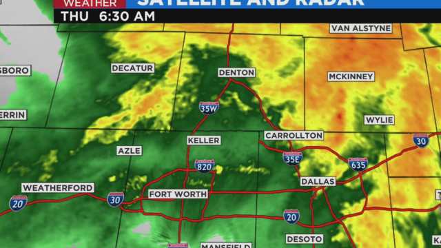
Rainfall rates in some areas of the Metroplex are estimated at up to 3.5".
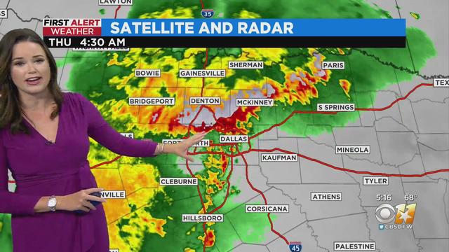
Heavy rain, frequent lightning, and gusty winds are the main features to watch for this morning.
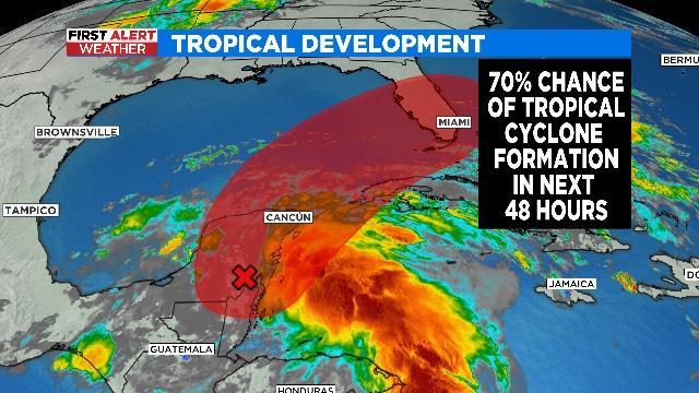
The first Tropical Depression of the Atlantic season is likely to form over the next 48 hours.
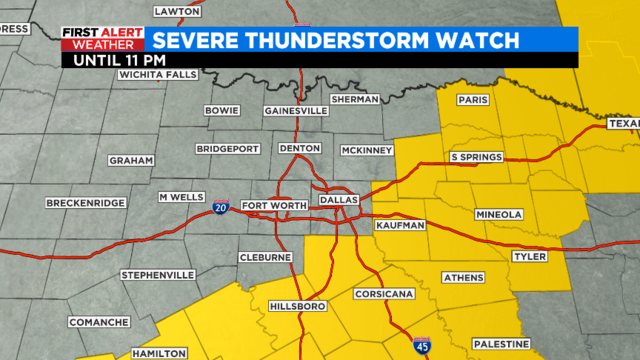
Storms are developing along a cold front moving through North Texas. Quarter size hail and damaging winds to 60 mph are the main threats.
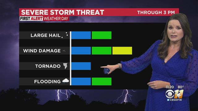
Showers and storms will develop ahead of a cold front this morning into early afternoon.
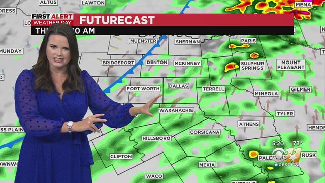
A cold front is slated to roll in later this morning, producing fairly widespread showers and storms.
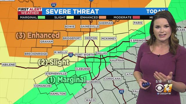
There are two rounds of potentially severe weather on the way in the next 48 hours.