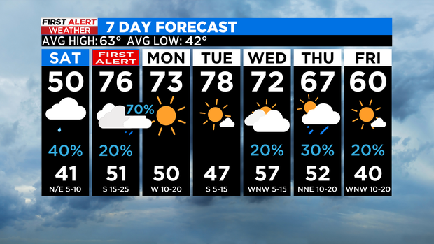
Warmer temps arrive Sunday, but rain and storms move in overnight
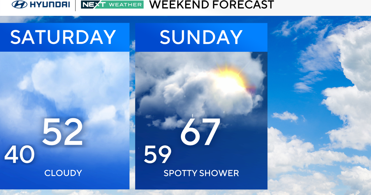
NORTH TEXAS (CBSTexasNews.com) – Friday evening will be cloudy and chilly with light scattered showers and drizzle possible. Not a lot changes with Saturday's forecast, but by Sunday our winds pick up out of the south and our temperatures jump back into the 70s.
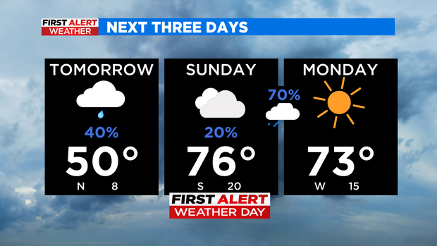
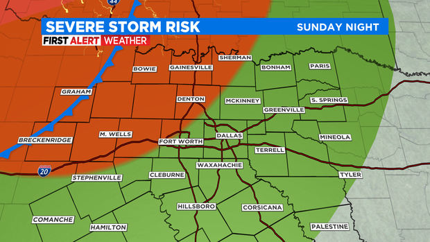
Let's talk about the latest with our First Alert Weather event Sunday evening. While the timing will be adjusted as we get closer to Sunday, right now we'll start to watch our western counties after 8 p.m. for a line of storms to move in. This line of storms should be out of our area before Monday morning.
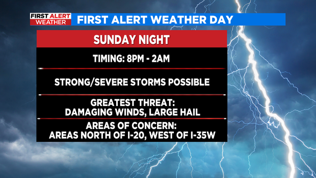
As the line moves east, the storms should weaken. What we're most concerned about with this line of storms will be 60+ mph damaging wind gusts and large hail.
It will be windy on Monday behind the overnight front. Highs will be able to warm into the 70s though, and we keep the warmer weather around through most of next week!