Weekend Forecast
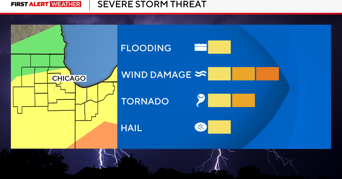
This afternoon an isolated thunderstorm could break the cap (a layer of warm air through the lower atmosphere that inhibits storm development). The dryline to our west will trigger these storms as in moves into our western edge (Montague down to Somervell counties). These storms could easily produce severe weather in the form of 58mph winds or higher along with 3/4" hail or larger. Larry and Jeff Jamison will be watching them carefully through the late afternoon and early evening if they develop. The risk to the race tonight at the Texas Speedway is very, very small.
SATURDAY
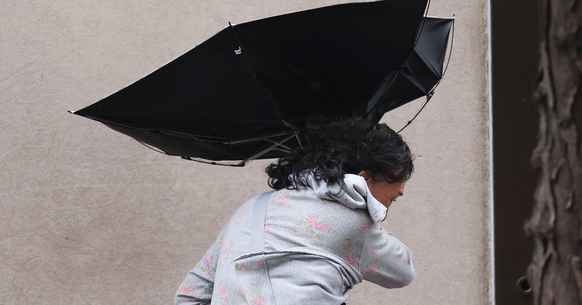
Another warm start with lows in the low 70's. We'll have highs in the low 90's from DFW and Arlington to the west with very strong south winds. Morning clouds and afternoon sun with high humidity, weather more like early June than early April. The winds will be very strong, gusts in the 35-40mph range so be carefull if grilling, out on the boat, even driving next to high profile cars or trucks. Saturday night for the race the winds will continue to be rather strong, it'll be a factor for the drivers.
SUNDAY
A cold front comes towards us on Sunday. It''ll be another very warm morning with lows in the 70's. But the front arrives mid-day or early afternoon triggering strong storms. The severe risk is higher to the north of the Red River and to our east but there is a chance around here depending on when the front arrives. Winds turn to the northwest on a very breezy day. High fire danger for the western third as the humidity lowers.
NEXT WEEK
Cooler start on Monday with lows in the low to mid-50's. Highs barely 80° with brisk north winds. Rain and storm chances show up again to over a little water for our parched lands. There looks to be a 20% chance late Wednesday and a 30% chance early Thursday.