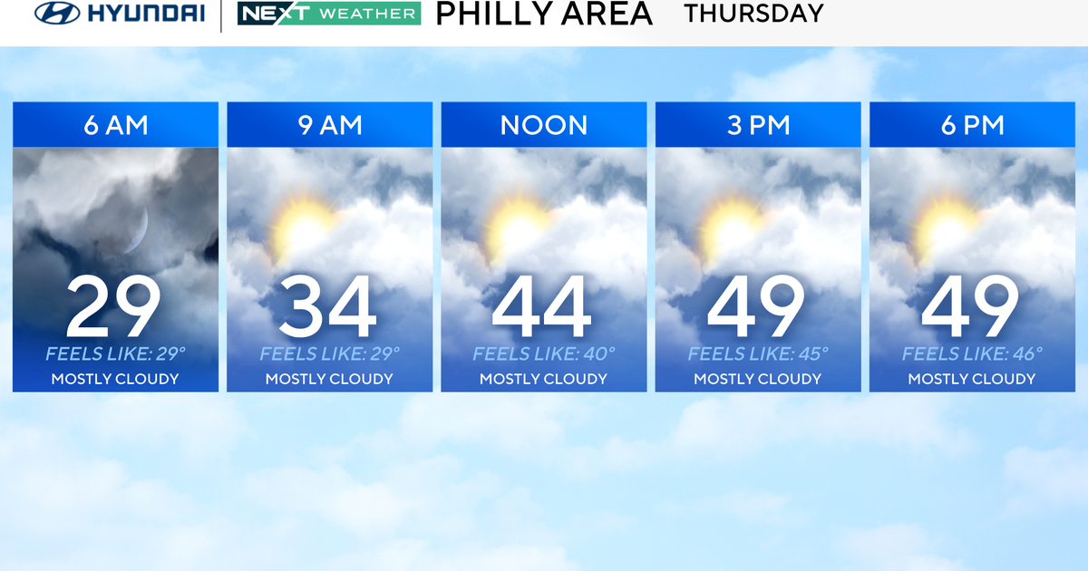
The @CBSDFW Weather Authority: Severe Weather Threat
We're off to a cloudy and warm start across
North Texas. Temperatures are in the lower-
70s across the Metroplex at this hour. Expect
drizzle and a few isolated showers popping up
later this morning/early afternoon.
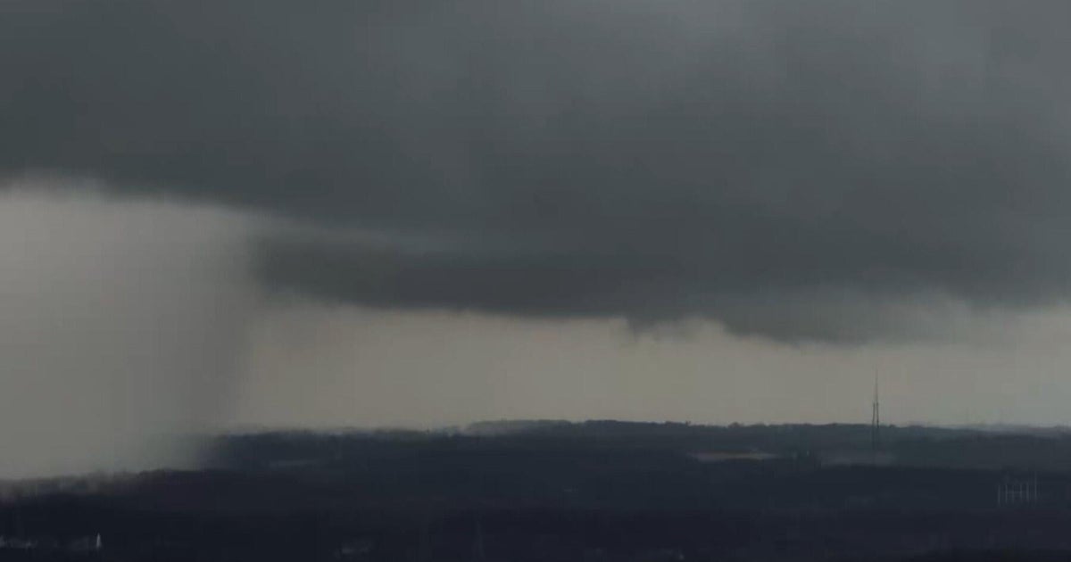
We'll see a round of strong storms developing
later this afternoon. A few of these storms
have the potation to become severe. The biggest
threat with the afternoon storms will be
localized flooding and gusty winds. The second
round of strong storms will move West to East
between 10pm -4am. This will be associated with
A cold from that will push through the Metroplex
around 2am.
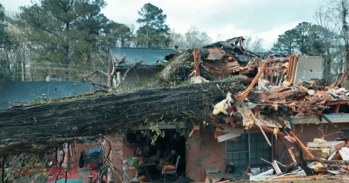
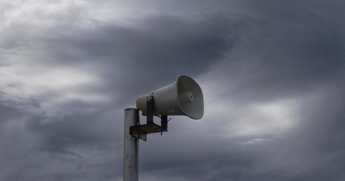
We're under a slight risk of sever weather
throughout the afternoon/night. Expect flash
flooding, winds gusting up to 60mph, quarter
size hail or less, frequent lightning strikes
and A few isolated tornadoes.
We'll clear out Sunday morning but expect breezy
winds and highs dropping into the 60s. 70s return
in the forecast early next week but another cold
front strikes and drops temperatures into the 50s.
No rain expected with that cold front.