Sunny, warm weekend continues, but storms return Monday
NORTH TEXAS (CBSDFW.COM) - Happy Saturday! What a gorgeous start to the weekend. Hopefully you were able to get outside and soak up some of the sun.
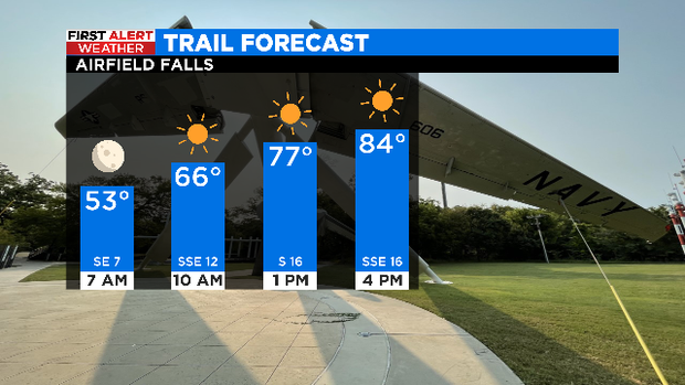
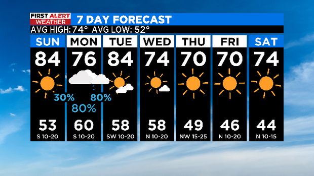
Another great trail day tomorrow! Sunny with highs in the mid 80s.
There is an elevated fire threat west of 281 tomorrow.
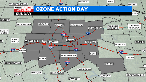
Unfortunately, Sunday is also an Ozone Action Day. If you have any respiratory issues you will want to minimize your time outdoors.
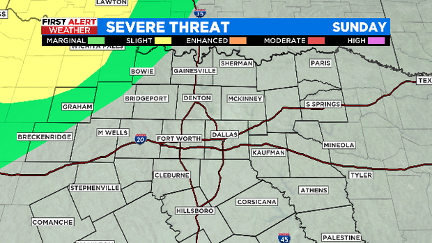
Sunday evening we will be watching for some storms in our western counties, there is a marginal risk of a few severe storms.
The metroplex will likely miss out on this round of rain, but some Red River counties may see showers from it overnight.
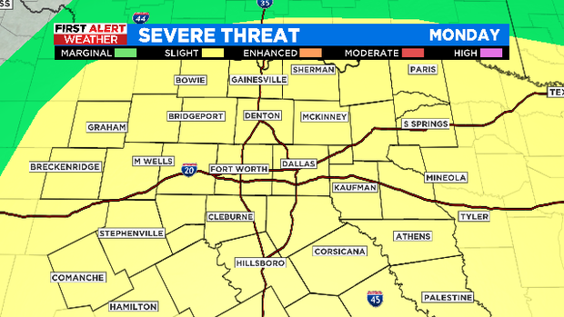
There is greater chance of severe storms for North Texas on Monday in the afternoon and evening hours.
Timing of the storms may shift a bit, but current thinking has them developing in western areas around 4 or 5 p.m., moving through Metroplex from 5 p.m. to 9 p.m., and clearing into East Texas by midnight.
The entire viewing area is under a slight risk, but this is not as potent of a setup that we had late March. Large hail and damaging winds are the main threats, but a few tornadoes are also possible.
A cold front passes through the area Tuesday evening dry but ushers in cooler air.
Sunshine and comfortable temperatures to wrap up the work week.
Grab some pie and enjoy the rest of your weekend!