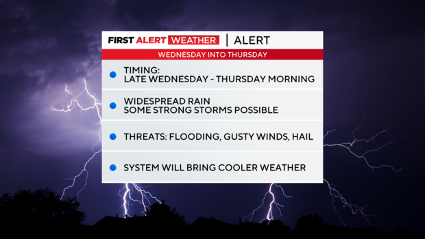
A cold front is on the way, bringing strong storms mid-week
NORTH TEXAS (CBSNewsTexas.com) – Big changes are on the way to your First Alert Forecast!
Today will be the last 90-degree day for the next several days before a strong cold front pushes into the area, giving way to rain and storms.
In fact, Wednesday and Thursday are Weather Alerts due to the threat for strong to severe storms in North Texas.

Parts of North Texas are under a marginal risk (level 1) for severe weather.

We'll likely see partly to mostly cloudy skies on Wednesday with a chance for scattered rain and storms.
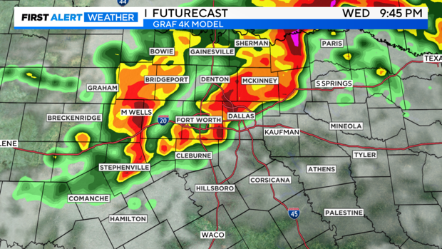
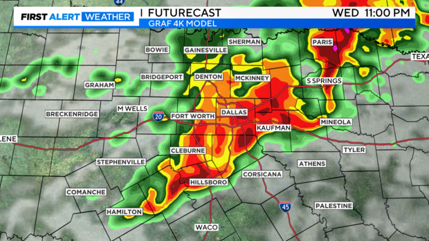
Rain chances will ramp up Wednesday evening and night as the cold front slides into the area from the northwest. The rain may become a bit widespread, capable of producing localized flooding. Remember, turn around, don't drown.
Any storms that develop could produce gusty winds and large hail.
Rain and storms will likely continue overnight Wednesday into Thursday morning.

Again, watch out for periods of heavy rain before heading to work and school. Some localized flooding will be possible. By Thursday afternoon, we'll see gradual clearing and sunshine.

High temperatures on Wednesday will be in the upper 80s, then temperatures will fall into the low 80s Thursday and Friday.
By Saturday and Sunday, even cooler weather is expected. Highs will be in the low to mid 70s. Overnight lows will be in the low to mid 50s.