Will it snow in the DFW metroplex? Dangerously low temperatures in the North Texas forecast

A First Alert Weather Day remains in effect through Wednesday morning for the dangerous "feels-like" temperatures.
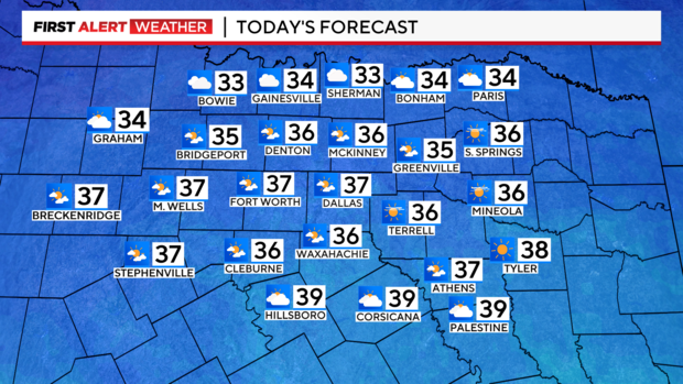
Cloud coverage increased Monday morning in North Texas and will continue through the morning to afternoon hours with some sunshine peeking through. However, don't plan on the sun warming up to more comfortable temperatures. Highs will still be in the mid to upper 30s but feel like the 20s most of the day.
Will it snow Monday and Tuesday in North Texas?
Snow returns on the First Alert radar but with very dry air still in place, most of it won't reach the surface. The dew points are in the single digits this morning.
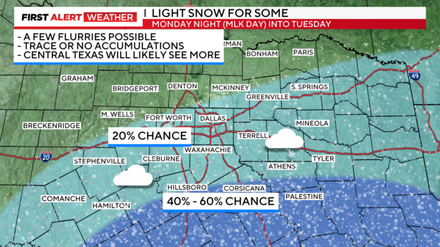
However, by later on Monday there is a 20% chance there could be some snow flurries in parts of North Texas with better snow chances in the southeast sides of North and Central Texas.
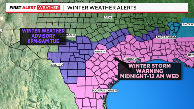
There are winter weather alerts in place from the National Weather Service with a winter weather advisory and a winter storm warning in place for parts of Texas, but not for Dallas-Fort Worth.
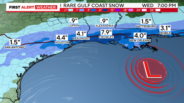
In Houston, all airports will close on Tuesday due to the expected winter storm.
A record-breaking storm system is on the way for the Texas coast as well as many Gulf Coast States with snow possible from Texas all the way to the Florida panhandle.
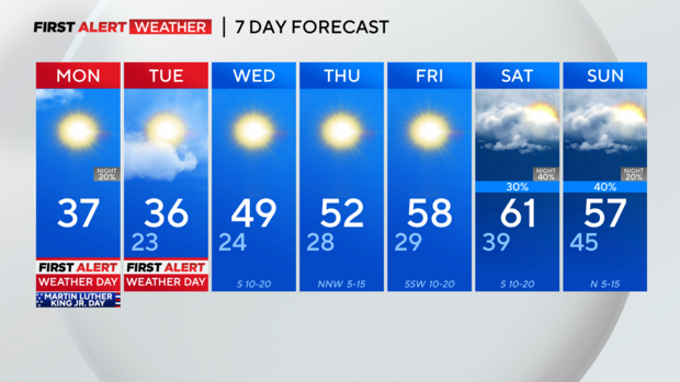
Temperatures will slowly warm and highs are near 60 degrees this weekend.