Severe storms head for North Texas
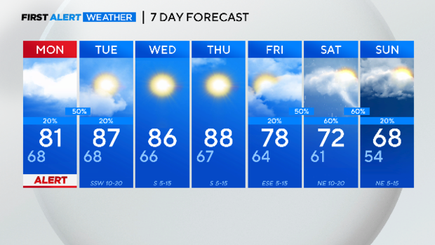
NORTH TEXAS — It will be humid and windy on your Monday with temps in the 80s sticking around until Thursday.
The First Alert Weather Team wants to First Alert you to the threat of severe weather on Monday.
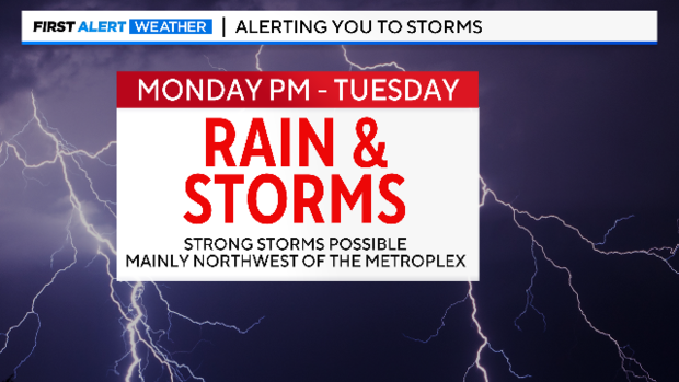
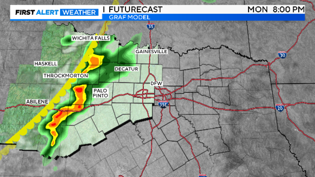
The severe threat just barely reaches the western edge of the metroplex Monday night. A strong cap is in place. These storms should weaken by the time they reach Tarrant and Dallas counties.

Large hail and damaging winds are the main threats in our western third as we get into the evening hours Monday.
The storms will likely lose their punch by late evening and overnight as they roll across North Texas.
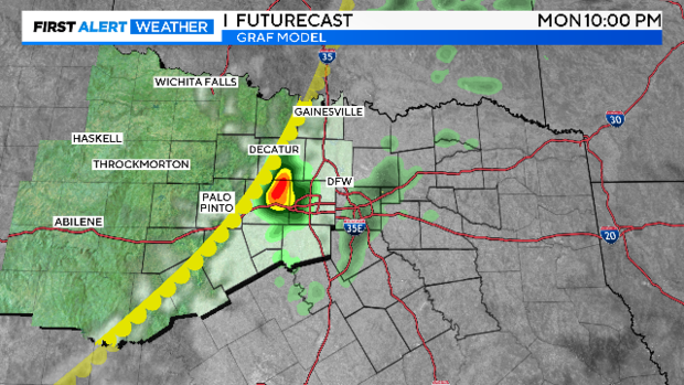
The threat of severe weather is high from Wise and Parker counties to the west Monday night. The First Alert Weather Team will be in place to help keep you safe.
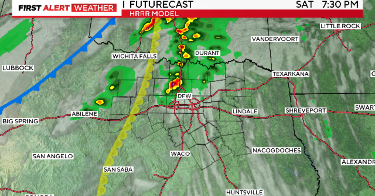
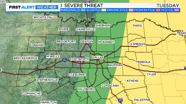
There is a threat of severe weather again Tuesday afternoon in our eastern counties. This is from a Pacific front coming behind the dryline and moving across us as we get across Tuesday. Large hail and damaging winds will again be the primary threat.
After this it'll be several days of very warm and nice days as we get near 90° for a high. By the start of the weekend, the rain chances quickly return. The first half of next weekend looks like a washout! It'll certainly be much cooler.