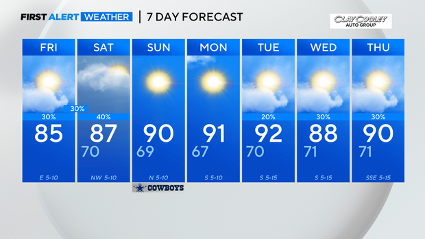
Scattered storms continue into the weekend
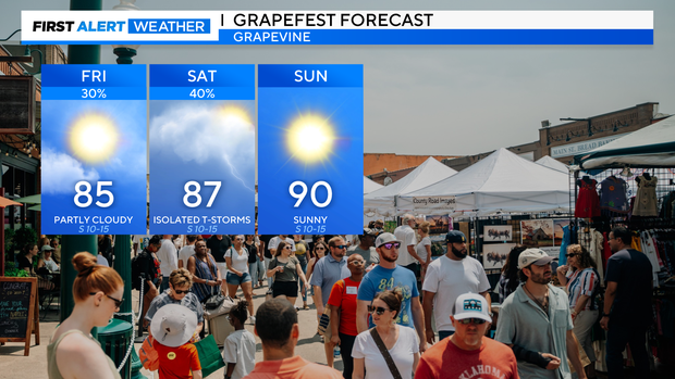
NORTH TEXAS (CBSNewsTexas.com) - Friday morning is off to a cloudy and comfortable start with temperatures in the low 70s. It will be noticeably warmer in the afternoon, as highs top out in the mid 80s. That is about 10 degrees warmer than Thursday, when temperatures only made it into the mid 70s.
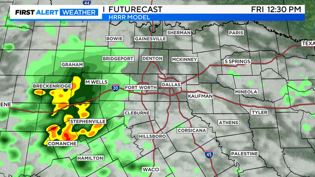
Spotty showers will develop Friday morning along a stalled out frontal boundary south of I-20 and a storm complex will move in from the west. The complex from our west will arrive around midday with the greatest chance for thunderstorms southwest of the Metroplex.
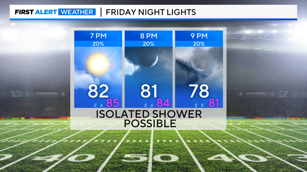
There will be a mix of sun and clouds later in the afternoon, with just an isolated shower possible for Friday Night Lights.
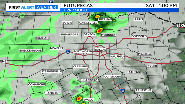
The unsettled weather pattern continues one last day into Saturday. Scattered showers and storms are possible throughout the day but there will be plenty of dry time in between any rain.
Although temperatures will warm up Sunday, they're just getting back to normal near 90. The sunshine lasts into Monday before rain chances return heading into the middle of the week.