Rest of the Day
A larger area of rain and thunderstorms have been affecting North Texas this morning. This has created a boundary called an "outflow boundary" across the southeastern counties in North Texas. It will be near this boundary where more thunderstorms will develop later this afternoon.
A true cold front is still north of us into Oklahoma, and as this front moves south during the day, we expect new, strong thunderstorms to develop on that front as well.
One of our computer models is showing what is likely to happen.
4pm: New storms fire up near Metroplex.
7pm: Storms quickly move south, increasing in strength due to outflow boundary.
10pm: Storms are out of the area
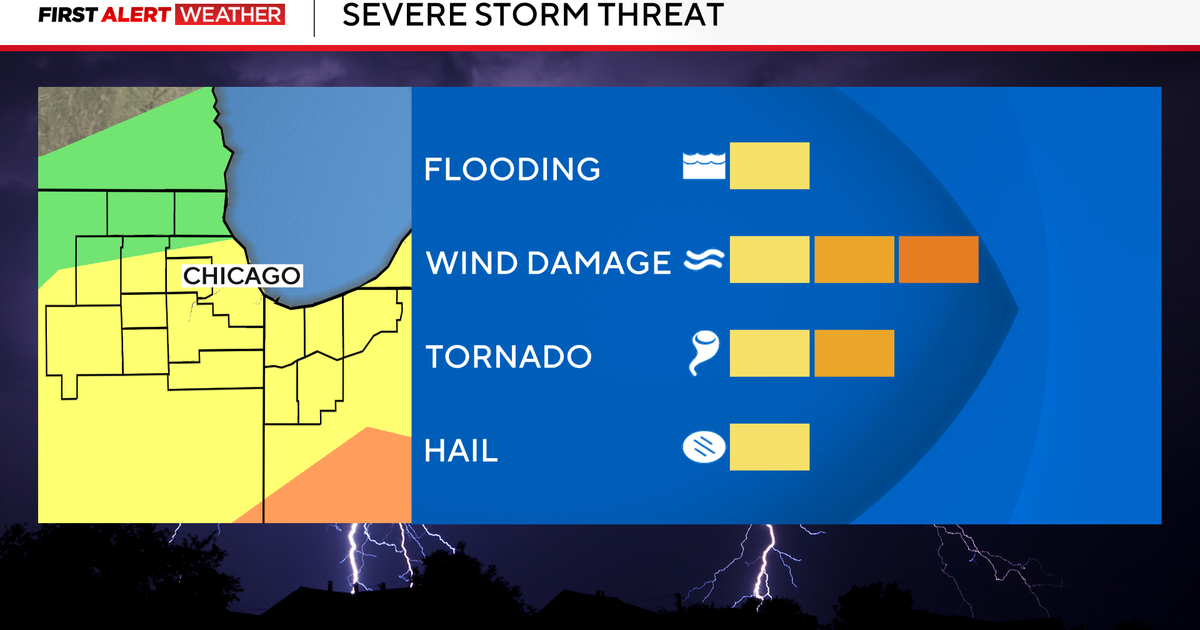
Overall, North Texas is under a SLIGHT RISK for severe storms today. The greatest potential for very large hail (baseballs) and possible tornadoes will be in our southeastern areas, closest to our outflow boundary.
Keep it here for more!


