More Storms Possible Thursday
After a quiet few days here in North Texas, we are expecting the humidity to increase dramatically overnight into Thursday. This will all ride in on a breezy south wind. We'll start off with clouds in the morning, but most of the area will see partly cloudy and warm weather by afternoon.
But as a cold front approaches from the west, a few thunderstorms will blossom first over Kansas & Oklahoma and then parts of North Texas close to sundown.
Starting around 7pm or so the atmosphere will become so unstable that the cold front will be able to generate a few thunderstorms mainly in the northeast corner of North Texas. The heart of this storm system will actually be in Kansas/Oklahoma, where there could be a significant severe weather outbreak Thursday evening.
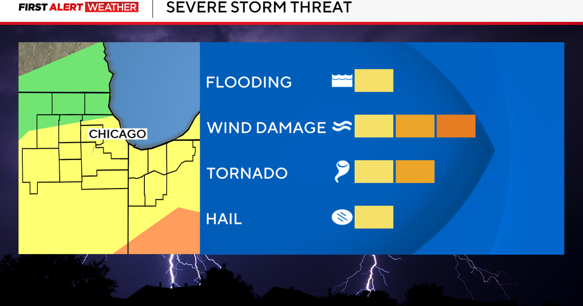
We will be on the southern extent of these storms, but the ones that do form in North Texas will quickly become strong to severe. There is a SLIGHT RISK for severe weather manly along and east of I-35 and then along and north of I-20. The nastiest storms tomorrow will produce golf ball sized hail, 60-80 mph winds, & possibly a tornado. We're not anticipating as many storms as what we had Sunday night/Monday morning...but the storms that do form could be quite strong.
Storms should quickly exit our area by midnight, leaving us with a cooler, but still windy, Friday. Lots of sunshine actually and quiet weather Friday-Monday.